
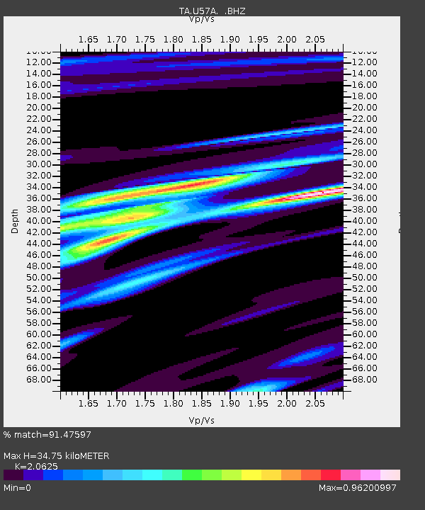
U57A Blanch, NC, USA - Earthquake Result Viewer
| ||||||||||||||||||
| ||||||||||||||||||
| ||||||||||||||||||
|
Signal To Noise
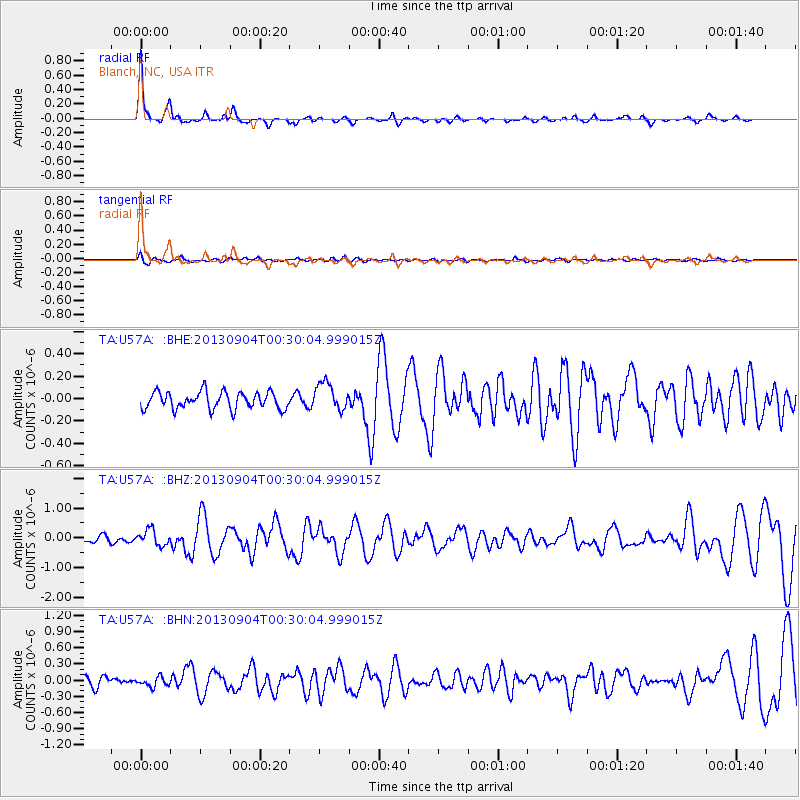
| Channel | StoN | STA | LTA |
| TA:U57A: :BHZ:20130904T00:30:04.999015Z | 2.1596081 | 2.6117195E-7 | 1.2093487E-7 |
| TA:U57A: :BHN:20130904T00:30:04.999015Z | 1.0304737 | 8.662042E-8 | 8.4058826E-8 |
| TA:U57A: :BHE:20130904T00:30:04.999015Z | 1.6317865 | 1.2444862E-7 | 7.626526E-8 |
| Arrivals | |
| Ps | 6.1 SECOND |
| PpPs | 16 SECOND |
| PsPs/PpSs | 22 SECOND |

