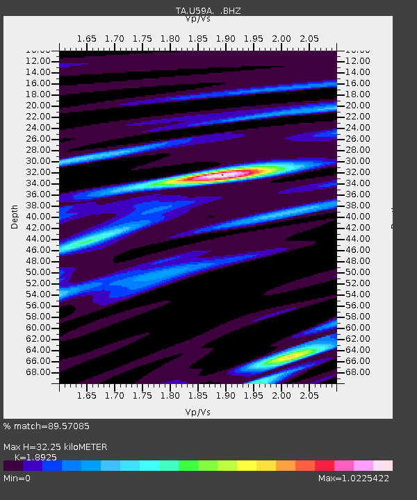
U59A Littleton, NC, USA - Earthquake Result Viewer
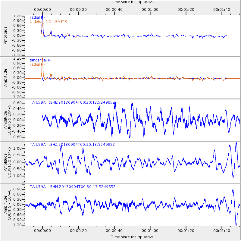
Earthquake location: Queen Charlotte Islands Region
Earthquake latitude/longitude: 51.2/-130.2
Earthquake time(UTC): 2013/09/04 (247) 00:23:11 GMT
Earthquake Depth: 9.9 km
Earthquake Magnitude: 6.0 MW, 5.9 MI, 5.9 MWR, 6.0 MWW, 6.0 MWW, 6.0 MWC
Earthquake Catalog/Contributor: NEIC PDE/NEIC COMCAT
Network: TA USArray Transportable Network (new EarthScope stations)
Station: U59A Littleton, NC, USA
Lat/Lon: 36.35 N/77.79 W
Elevation: 99 m
Distance: 39.8 deg
Az: 90.988 deg
Baz: 308.783 deg
Ray Param: 0.074780025
Estimated Moho Depth: 32.25 km
Estimated Crust Vp/Vs: 1.89
Assumed Crust Vp: 6.565 km/s
Estimated Crust Vs: 3.469 km/s
Estimated Crust Poisson's Ratio: 0.31
Radial Match: 89.57085 %
Radial Bump: 237
Transverse Match: 56.682602 %
Transverse Bump: 400
SOD ConfigId: 626651
Insert Time: 2014-04-18 09:43:49.024 +0000
GWidth: 2.5
Max Bumps: 400
Tol: 0.001

Signal To Noise

ChannelStoNSTALTA
TA:U59A: :BHZ:20130904T00:30:13.524985Z2.66094372.4311836E-79.1365465E-8
TA:U59A: :BHN:20130904T00:30:13.524985Z1.22791871.1026426E-78.979768E-8
TA:U59A: :BHE:20130904T00:30:13.524985Z1.97185662.3268497E-71.1800299E-7
Arrivals
Ps4.7 SECOND
PpPs13 SECOND
PsPs/PpSs18 SECOND