
V50A Pikevile, TN, USA - Earthquake Result Viewer
| ||||||||||||||||||
| ||||||||||||||||||
| ||||||||||||||||||
|
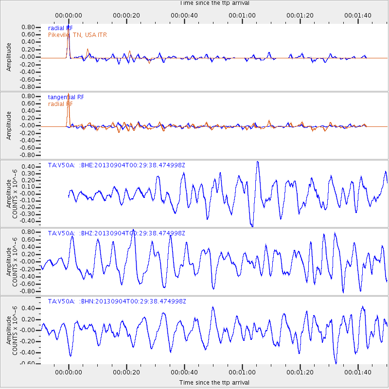
Signal To Noise
| Channel | StoN | STA | LTA |
| TA:V50A: :BHZ:20130904T00:29:38.474998Z | 3.6652148 | 3.4936866E-7 | 9.53201E-8 |
| TA:V50A: :BHN:20130904T00:29:38.474998Z | 3.4888768 | 2.2015206E-7 | 6.3101126E-8 |
| TA:V50A: :BHE:20130904T00:29:38.474998Z | 2.2655752 | 1.3338214E-7 | 5.887341E-8 |
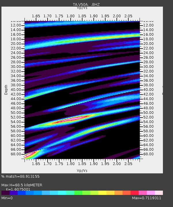
| Arrivals | |
| Ps | 7.1 SECOND |
| PpPs | 26 SECOND |
| PsPs/PpSs | 33 SECOND |

