V53A Saluda, NC, USA - Earthquake Result Viewer
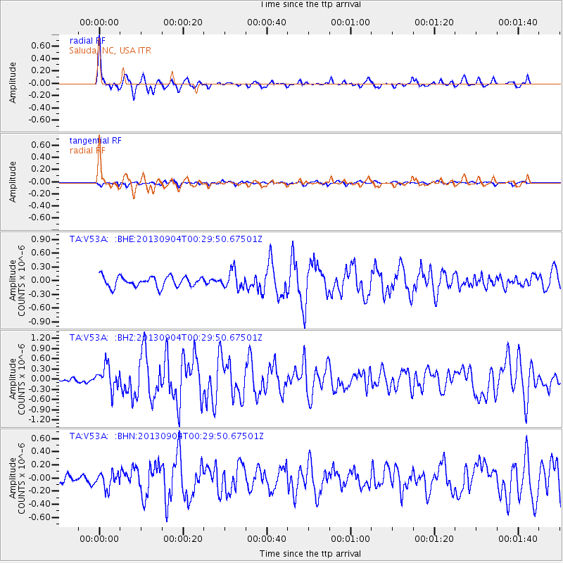
Earthquake location: Queen Charlotte Islands Region
Earthquake latitude/longitude: 51.2/-130.2
Earthquake time(UTC): 2013/09/04 (247) 00:23:11 GMT
Earthquake Depth: 9.9 km
Earthquake Magnitude: 6.0 MW, 5.9 MI, 5.9 MWR, 6.0 MWW, 6.0 MWW, 6.0 MWC
Earthquake Catalog/Contributor: NEIC PDE/NEIC COMCAT
Network: TA USArray Transportable Network (new EarthScope stations)
Station: V53A Saluda, NC, USA
Lat/Lon: 35.67 N/82.81 W
Elevation: 681 m
Distance: 37.1 deg
Az: 95.982 deg
Baz: 309.757 deg
Ray Param: 0.07633772
Estimated Moho Depth: 16.5 km
Estimated Crust Vp/Vs: 1.71
Assumed Crust Vp: 6.35 km/s
Estimated Crust Vs: 3.719 km/s
Estimated Crust Poisson's Ratio: 0.24
Radial Match: 86.82305 %
Radial Bump: 335
Transverse Match: 68.58914 %
Transverse Bump: 400
SOD ConfigId: 626651
Insert Time: 2014-04-18 09:44:02.842 +0000
GWidth: 2.5
Max Bumps: 400
Tol: 0.001

Signal To Noise

ChannelStoNSTALTA
TA:V53A: :BHZ:20130904T00:29:50.67501Z2.90493423.520124E-71.2117741E-7
TA:V53A: :BHN:20130904T00:29:50.67501Z1.53768181.1661543E-77.5838464E-8
TA:V53A: :BHE:20130904T00:29:50.67501Z1.74498331.9436327E-71.11384026E-7
Arrivals
Ps2.0 SECOND
PpPs6.5 SECOND
PsPs/PpSs8.5 SECOND