W39A Magazine, AR, USA - Earthquake Result Viewer
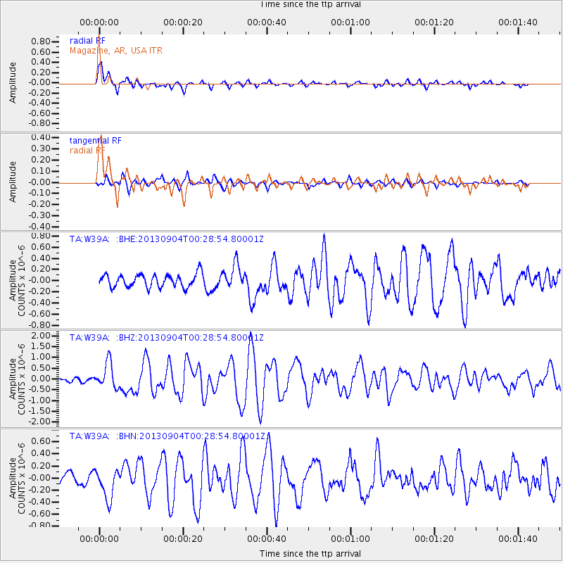
Earthquake location: Queen Charlotte Islands Region
Earthquake latitude/longitude: 51.2/-130.2
Earthquake time(UTC): 2013/09/04 (247) 00:23:11 GMT
Earthquake Depth: 9.9 km
Earthquake Magnitude: 6.0 MW, 5.9 MI, 5.9 MWR, 6.0 MWW, 6.0 MWW, 6.0 MWC
Earthquake Catalog/Contributor: NEIC PDE/NEIC COMCAT
Network: TA USArray Transportable Network (new EarthScope stations)
Station: W39A Magazine, AR, USA
Lat/Lon: 35.20 N/93.78 W
Elevation: 162 m
Distance: 30.6 deg
Az: 107.229 deg
Baz: 312.778 deg
Ray Param: 0.07928453
Estimated Moho Depth: 17.0 km
Estimated Crust Vp/Vs: 1.70
Assumed Crust Vp: 6.498 km/s
Estimated Crust Vs: 3.822 km/s
Estimated Crust Poisson's Ratio: 0.24
Radial Match: 88.11111 %
Radial Bump: 375
Transverse Match: 61.924446 %
Transverse Bump: 400
SOD ConfigId: 626651
Insert Time: 2014-04-18 09:44:16.978 +0000
GWidth: 2.5
Max Bumps: 400
Tol: 0.001

Signal To Noise

ChannelStoNSTALTA
TA:W39A: :BHZ:20130904T00:28:54.80001Z4.2968766.1320657E-71.4270987E-7
TA:W39A: :BHN:20130904T00:28:54.80001Z1.88043942.5752692E-71.369504E-7
TA:W39A: :BHE:20130904T00:28:54.80001Z1.890912.1919118E-71.1591836E-7
Arrivals
Ps2.0 SECOND
PpPs6.5 SECOND
PsPs/PpSs8.5 SECOND