W58A Raeford, NC, USA - Earthquake Result Viewer
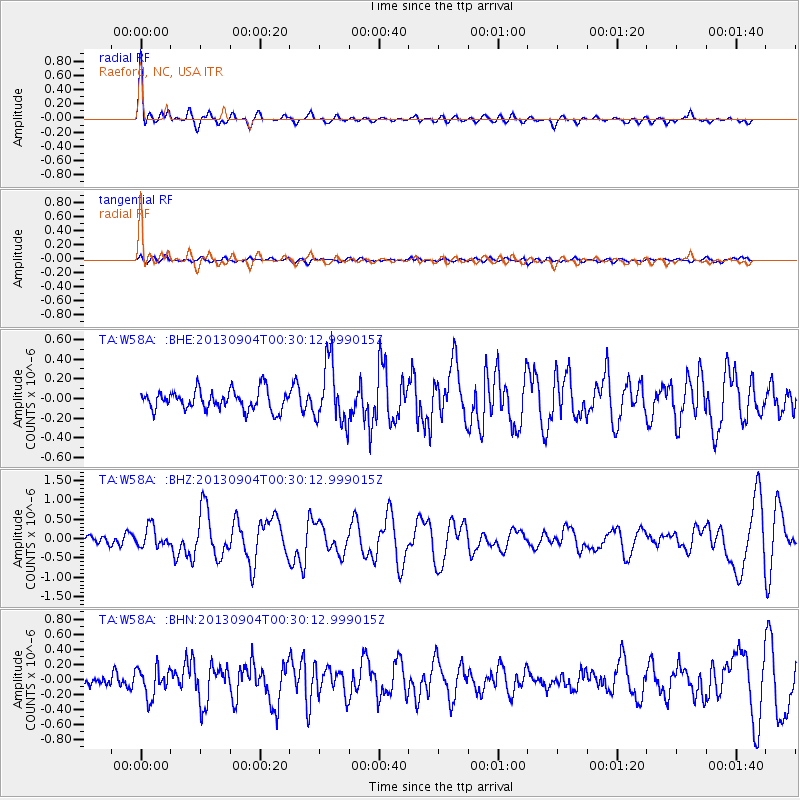
Earthquake location: Queen Charlotte Islands Region
Earthquake latitude/longitude: 51.2/-130.2
Earthquake time(UTC): 2013/09/04 (247) 00:23:11 GMT
Earthquake Depth: 9.9 km
Earthquake Magnitude: 6.0 MW, 5.9 MI, 5.9 MWR, 6.0 MWW, 6.0 MWW, 6.0 MWC
Earthquake Catalog/Contributor: NEIC PDE/NEIC COMCAT
Network: TA USArray Transportable Network (new EarthScope stations)
Station: W58A Raeford, NC, USA
Lat/Lon: 35.02 N/79.23 W
Elevation: 84 m
Distance: 39.7 deg
Az: 93.758 deg
Baz: 310.076 deg
Ray Param: 0.074817516
Estimated Moho Depth: 67.5 km
Estimated Crust Vp/Vs: 1.96
Assumed Crust Vp: 6.565 km/s
Estimated Crust Vs: 3.345 km/s
Estimated Crust Poisson's Ratio: 0.32
Radial Match: 86.506294 %
Radial Bump: 400
Transverse Match: 55.536785 %
Transverse Bump: 400
SOD ConfigId: 626651
Insert Time: 2014-04-18 09:44:33.761 +0000
GWidth: 2.5
Max Bumps: 400
Tol: 0.001

Signal To Noise

ChannelStoNSTALTA
TA:W58A: :BHZ:20130904T00:30:12.999015Z1.89961212.5935915E-71.365327E-7
TA:W58A: :BHN:20130904T00:30:12.999015Z2.31566261.9069721E-78.235103E-8
TA:W58A: :BHE:20130904T00:30:12.999015Z3.0508893.0730772E-71.0072728E-7
Arrivals
Ps11 SECOND
PpPs28 SECOND
PsPs/PpSs39 SECOND