X51A Calhoun, GA, USA - Earthquake Result Viewer
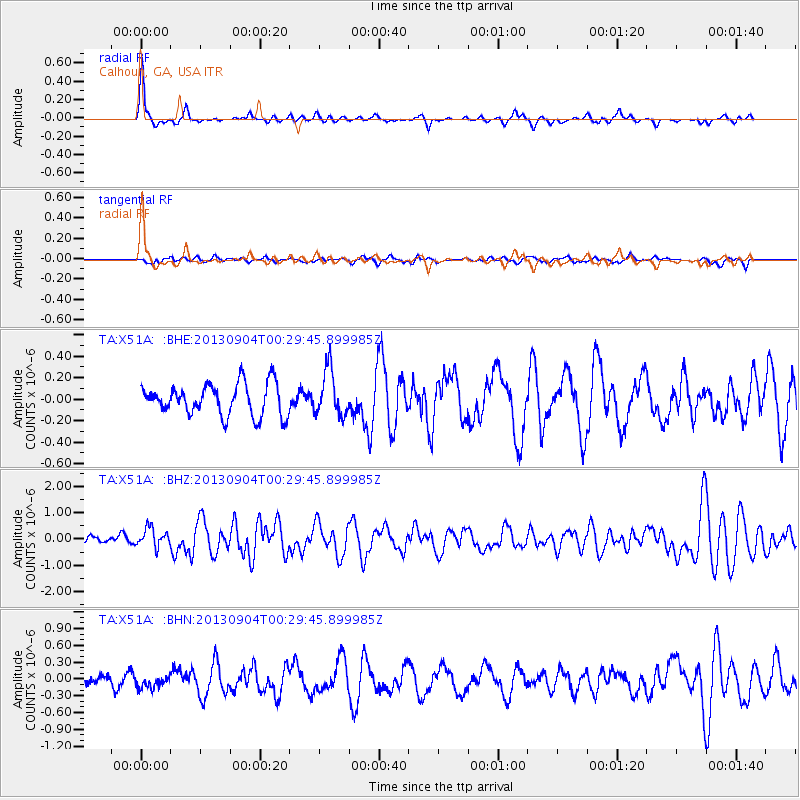
Earthquake location: Queen Charlotte Islands Region
Earthquake latitude/longitude: 51.2/-130.2
Earthquake time(UTC): 2013/09/04 (247) 00:23:11 GMT
Earthquake Depth: 9.9 km
Earthquake Magnitude: 6.0 MW, 5.9 MI, 5.9 MWR, 6.0 MWW, 6.0 MWW, 6.0 MWC
Earthquake Catalog/Contributor: NEIC PDE/NEIC COMCAT
Network: TA USArray Transportable Network (new EarthScope stations)
Station: X51A Calhoun, GA, USA
Lat/Lon: 34.57 N/84.86 W
Elevation: 214 m
Distance: 36.5 deg
Az: 99.198 deg
Baz: 311.162 deg
Ray Param: 0.07664351
Estimated Moho Depth: 63.75 km
Estimated Crust Vp/Vs: 1.71
Assumed Crust Vp: 6.35 km/s
Estimated Crust Vs: 3.724 km/s
Estimated Crust Poisson's Ratio: 0.24
Radial Match: 80.590645 %
Radial Bump: 345
Transverse Match: 37.28147 %
Transverse Bump: 400
SOD ConfigId: 626651
Insert Time: 2014-04-18 09:44:45.542 +0000
GWidth: 2.5
Max Bumps: 400
Tol: 0.001

Signal To Noise

ChannelStoNSTALTA
TA:X51A: :BHZ:20130904T00:29:45.899985Z1.99752023.6030465E-71.8037598E-7
TA:X51A: :BHN:20130904T00:29:45.899985Z0.860050861.1040877E-71.283747E-7
TA:X51A: :BHE:20130904T00:29:45.899985Z1.46001222.1303477E-71.45913E-7
Arrivals
Ps7.6 SECOND
PpPs25 SECOND
PsPs/PpSs33 SECOND