
Y52A Lilburn, GA, USA - Earthquake Result Viewer
| ||||||||||||||||||
| ||||||||||||||||||
| ||||||||||||||||||
|
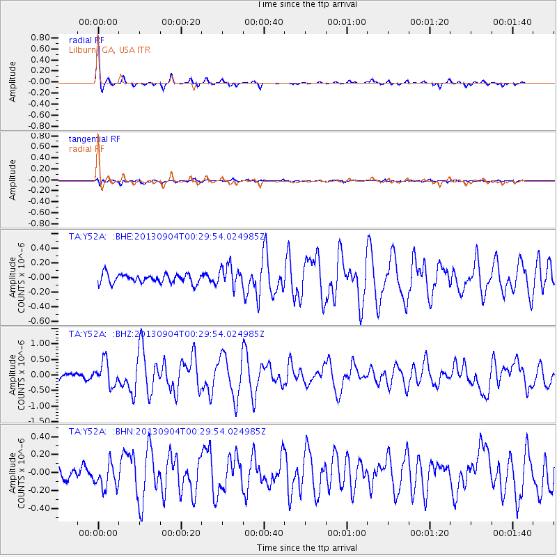
Signal To Noise
| Channel | StoN | STA | LTA |
| TA:Y52A: :BHZ:20130904T00:29:54.024985Z | 4.2794456 | 3.9402775E-7 | 9.207449E-8 |
| TA:Y52A: :BHN:20130904T00:29:54.024985Z | 1.735066 | 1.4124588E-7 | 8.1406625E-8 |
| TA:Y52A: :BHE:20130904T00:29:54.024985Z | 2.2972565 | 1.4290056E-7 | 6.2204876E-8 |
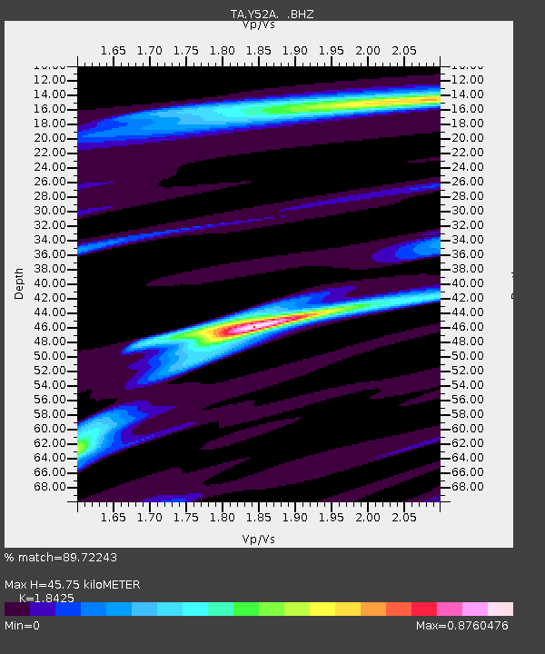
| Arrivals | |
| Ps | 6.2 SECOND |
| PpPs | 18 SECOND |
| PsPs/PpSs | 24 SECOND |

