
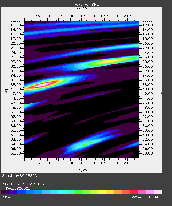
Y54A Tignall, GA, USA - Earthquake Result Viewer
| ||||||||||||||||||
| ||||||||||||||||||
| ||||||||||||||||||
|
Signal To Noise
| Channel | StoN | STA | LTA |
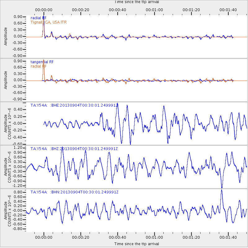
| TA:Y54A: :BHZ:20130904T00:30:01.249991Z | 2.2408154 | 2.846433E-7 | 1.2702667E-7 |
| TA:Y54A: :BHN:20130904T00:30:01.249991Z | 1.7056475 | 1.4753049E-7 | 8.649529E-8 |
| TA:Y54A: :BHE:20130904T00:30:01.249991Z | 2.368601 | 1.5127293E-7 | 6.386594E-8 |
| Arrivals | |
| Ps | 4.2 SECOND |
| PpPs | 14 SECOND |
| PsPs/PpSs | 18 SECOND |

