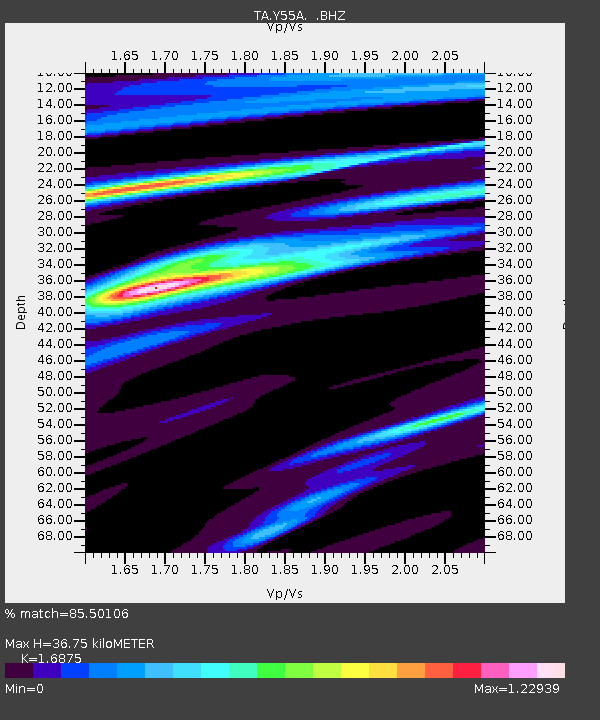
Y55A Saluda, SC, USA - Earthquake Result Viewer
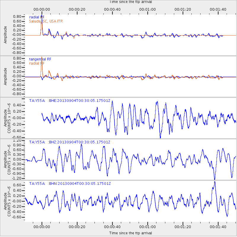
Earthquake location: Queen Charlotte Islands Region
Earthquake latitude/longitude: 51.2/-130.2
Earthquake time(UTC): 2013/09/04 (247) 00:23:11 GMT
Earthquake Depth: 9.9 km
Earthquake Magnitude: 6.0 MW, 5.9 MI, 5.9 MWR, 6.0 MWW, 6.0 MWW, 6.0 MWC
Earthquake Catalog/Contributor: NEIC PDE/NEIC COMCAT
Network: TA USArray Transportable Network (new EarthScope stations)
Station: Y55A Saluda, SC, USA
Lat/Lon: 33.94 N/81.86 W
Elevation: 164 m
Distance: 38.8 deg
Az: 97.287 deg
Baz: 311.329 deg
Ray Param: 0.075360015
Estimated Moho Depth: 36.75 km
Estimated Crust Vp/Vs: 1.69
Assumed Crust Vp: 6.565 km/s
Estimated Crust Vs: 3.89 km/s
Estimated Crust Poisson's Ratio: 0.23
Radial Match: 85.50106 %
Radial Bump: 400
Transverse Match: 58.09383 %
Transverse Bump: 400
SOD ConfigId: 626651
Insert Time: 2014-04-18 09:45:14.661 +0000
GWidth: 2.5
Max Bumps: 400
Tol: 0.001

Signal To Noise

ChannelStoNSTALTA
TA:Y55A: :BHZ:20130904T00:30:05.17501Z4.4167113.4626353E-77.839851E-8
TA:Y55A: :BHN:20130904T00:30:05.17501Z1.75902531.5376921E-78.741728E-8
TA:Y55A: :BHE:20130904T00:30:05.17501Z2.20670341.5686332E-77.108491E-8
Arrivals
Ps4.2 SECOND
PpPs14 SECOND
PsPs/PpSs18 SECOND