Z41A Richland Creek Farm, El Dorado, AR, USA - Earthquake Result Viewer
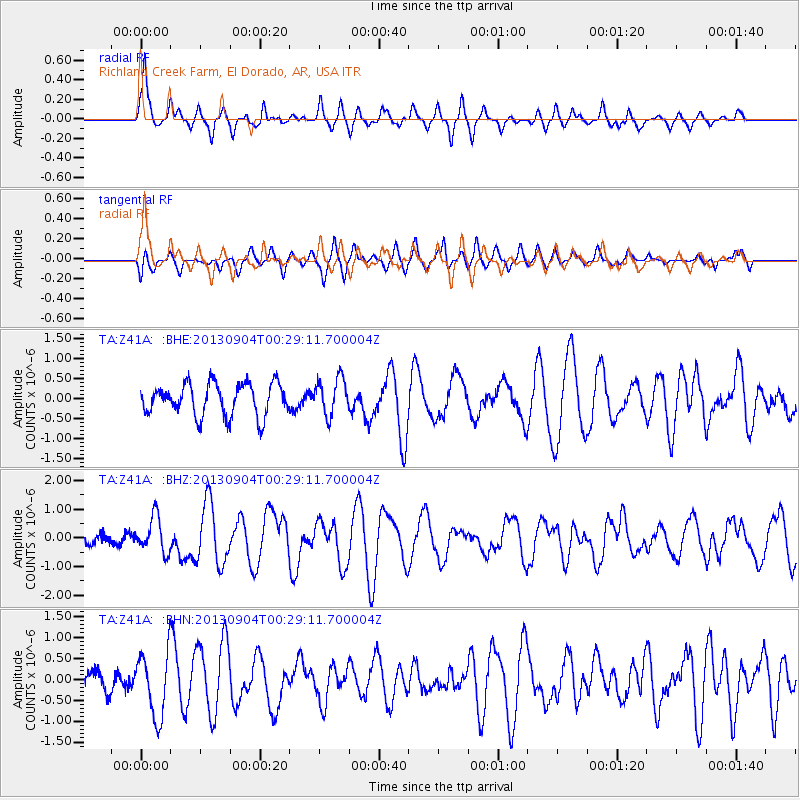
Earthquake location: Queen Charlotte Islands Region
Earthquake latitude/longitude: 51.2/-130.2
Earthquake time(UTC): 2013/09/04 (247) 00:23:11 GMT
Earthquake Depth: 9.9 km
Earthquake Magnitude: 6.0 MW, 5.9 MI, 5.9 MWR, 6.0 MWW, 6.0 MWW, 6.0 MWC
Earthquake Catalog/Contributor: NEIC PDE/NEIC COMCAT
Network: TA USArray Transportable Network (new EarthScope stations)
Station: Z41A Richland Creek Farm, El Dorado, AR, USA
Lat/Lon: 33.26 N/92.80 W
Elevation: 62 m
Distance: 32.5 deg
Az: 108.824 deg
Baz: 314.686 deg
Ray Param: 0.07860707
Estimated Moho Depth: 31.75 km
Estimated Crust Vp/Vs: 1.94
Assumed Crust Vp: 6.245 km/s
Estimated Crust Vs: 3.223 km/s
Estimated Crust Poisson's Ratio: 0.32
Radial Match: 81.011856 %
Radial Bump: 365
Transverse Match: 56.306366 %
Transverse Bump: 400
SOD ConfigId: 626651
Insert Time: 2014-04-18 09:45:20.143 +0000
GWidth: 2.5
Max Bumps: 400
Tol: 0.001

Signal To Noise

ChannelStoNSTALTA
TA:Z41A: :BHZ:20130904T00:29:11.700004Z4.30030736.246686E-71.4526137E-7
TA:Z41A: :BHN:20130904T00:29:11.700004Z2.09342057.707313E-73.681684E-7
TA:Z41A: :BHE:20130904T00:29:11.700004Z1.14310994.5286131E-73.96166E-7
Arrivals
Ps5.1 SECOND
PpPs14 SECOND
PsPs/PpSs19 SECOND