TZTN Tazewell, Tennessee, USA - Earthquake Result Viewer
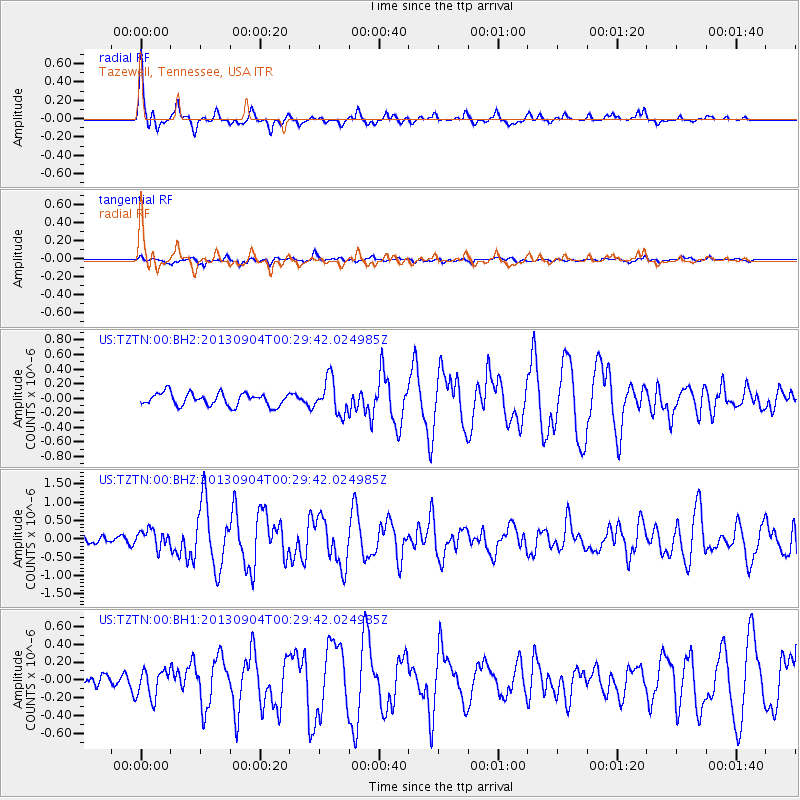
Earthquake location: Queen Charlotte Islands Region
Earthquake latitude/longitude: 51.2/-130.2
Earthquake time(UTC): 2013/09/04 (247) 00:23:11 GMT
Earthquake Depth: 9.9 km
Earthquake Magnitude: 6.0 MW, 5.9 MI, 5.9 MWR, 6.0 MWW, 6.0 MWW, 6.0 MWC
Earthquake Catalog/Contributor: NEIC PDE/NEIC COMCAT
Network: US United States National Seismic Network
Station: TZTN Tazewell, Tennessee, USA
Lat/Lon: 36.54 N/83.55 W
Elevation: 394 m
Distance: 36.1 deg
Az: 95.484 deg
Baz: 308.925 deg
Ray Param: 0.0768904
Estimated Moho Depth: 19.5 km
Estimated Crust Vp/Vs: 1.61
Assumed Crust Vp: 6.476 km/s
Estimated Crust Vs: 4.022 km/s
Estimated Crust Poisson's Ratio: 0.19
Radial Match: 90.29958 %
Radial Bump: 334
Transverse Match: 71.0445 %
Transverse Bump: 400
SOD ConfigId: 626651
Insert Time: 2014-04-18 09:46:29.719 +0000
GWidth: 2.5
Max Bumps: 400
Tol: 0.001

Signal To Noise

ChannelStoNSTALTA
US:TZTN:00:BHZ:20130904T00:29:42.024985Z1.59405142.4050112E-71.5087414E-7
US:TZTN:00:BH1:20130904T00:29:42.024985Z1.94224671.5558909E-78.010779E-8
US:TZTN:00:BH2:20130904T00:29:42.024985Z2.70217062.3491879E-78.6937064E-8
Arrivals
Ps2.0 SECOND
PpPs7.2 SECOND
PsPs/PpSs9.2 SECOND