LVA2 AZ.LVA2 - Earthquake Result Viewer
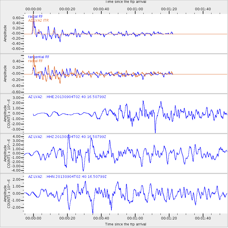
Earthquake location: Andreanof Islands, Aleutian Is.
Earthquake latitude/longitude: 51.6/-174.8
Earthquake time(UTC): 2013/09/04 (247) 02:32:30 GMT
Earthquake Depth: 20 km
Earthquake Magnitude: 6.5 MWW, 5.9 ML, 6.3 MWB, 6.5 MI, 6.5 MWC, 6.5 MWW
Earthquake Catalog/Contributor: NEIC PDE/NEIC COMCAT
Network: AZ ANZA Regional Network
Station: LVA2 AZ.LVA2
Lat/Lon: 33.35 N/116.56 W
Elevation: 1435 m
Distance: 45.3 deg
Az: 90.233 deg
Baz: 311.767 deg
Ray Param: 0.07130922
Estimated Moho Depth: 32.5 km
Estimated Crust Vp/Vs: 1.60
Assumed Crust Vp: 6.264 km/s
Estimated Crust Vs: 3.915 km/s
Estimated Crust Poisson's Ratio: 0.18
Radial Match: 91.271835 %
Radial Bump: 400
Transverse Match: 77.1928 %
Transverse Bump: 400
SOD ConfigId: 626651
Insert Time: 2014-04-18 09:49:04.224 +0000
GWidth: 2.5
Max Bumps: 400
Tol: 0.001

Signal To Noise

ChannelStoNSTALTA
AZ:LVA2: :HHZ:20130904T02:40:16.50799Z2.86194046.401756E-72.2368584E-7
AZ:LVA2: :HHN:20130904T02:40:16.50799Z2.1876823.3168814E-71.5161626E-7
AZ:LVA2: :HHE:20130904T02:40:16.50799Z1.1419072.3373623E-72.0468937E-7
Arrivals
Ps3.3 SECOND
PpPs13 SECOND
PsPs/PpSs16 SECOND