SMER AZ.SMER - Earthquake Result Viewer
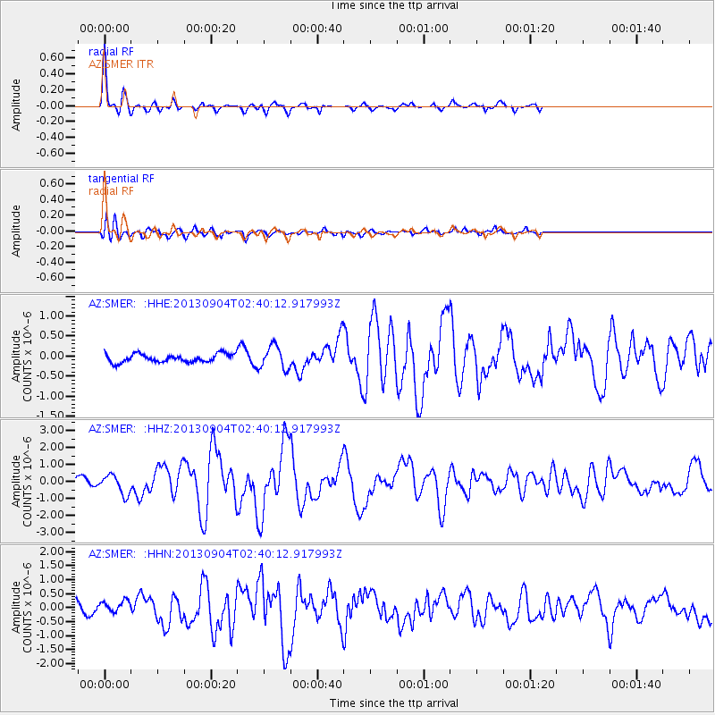
Earthquake location: Andreanof Islands, Aleutian Is.
Earthquake latitude/longitude: 51.6/-174.8
Earthquake time(UTC): 2013/09/04 (247) 02:32:30 GMT
Earthquake Depth: 20 km
Earthquake Magnitude: 6.5 MWW, 5.9 ML, 6.3 MWB, 6.5 MI, 6.5 MWC, 6.5 MWW
Earthquake Catalog/Contributor: NEIC PDE/NEIC COMCAT
Network: AZ ANZA Regional Network
Station: SMER AZ.SMER
Lat/Lon: 33.46 N/117.17 W
Elevation: 355 m
Distance: 44.9 deg
Az: 90.6 deg
Baz: 311.692 deg
Ray Param: 0.07160664
Estimated Moho Depth: 32.25 km
Estimated Crust Vp/Vs: 1.74
Assumed Crust Vp: 6.264 km/s
Estimated Crust Vs: 3.605 km/s
Estimated Crust Poisson's Ratio: 0.25
Radial Match: 92.88957 %
Radial Bump: 310
Transverse Match: 68.255745 %
Transverse Bump: 400
SOD ConfigId: 626651
Insert Time: 2014-04-18 09:49:12.177 +0000
GWidth: 2.5
Max Bumps: 400
Tol: 0.001

Signal To Noise

ChannelStoNSTALTA
AZ:SMER: :HHZ:20130904T02:40:12.917993Z3.59302785.673787E-71.5791103E-7
AZ:SMER: :HHN:20130904T02:40:12.917993Z1.11073222.1678045E-71.9516897E-7
AZ:SMER: :HHE:20130904T02:40:12.917993Z2.81902362.883604E-71.0229088E-7
Arrivals
Ps4.0 SECOND
PpPs13 SECOND
PsPs/PpSs17 SECOND