HEH Heihe,Heilongjiang Province - Earthquake Result Viewer
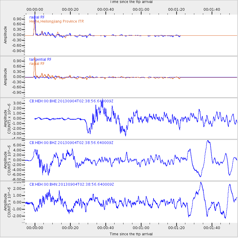
Earthquake location: Andreanof Islands, Aleutian Is.
Earthquake latitude/longitude: 51.6/-174.8
Earthquake time(UTC): 2013/09/04 (247) 02:32:30 GMT
Earthquake Depth: 20 km
Earthquake Magnitude: 6.5 MWW, 5.9 ML, 6.3 MWB, 6.5 MI, 6.5 MWC, 6.5 MWW
Earthquake Catalog/Contributor: NEIC PDE/NEIC COMCAT
Network: CB China National Seismic Network
Station: HEH Heihe,Heilongjiang Province
Lat/Lon: 50.25 N/127.41 E
Elevation: 165 m
Distance: 35.7 deg
Az: 291.281 deg
Baz: 64.986 deg
Ray Param: 0.077074766
Estimated Moho Depth: 31.75 km
Estimated Crust Vp/Vs: 1.79
Assumed Crust Vp: 6.419 km/s
Estimated Crust Vs: 3.581 km/s
Estimated Crust Poisson's Ratio: 0.27
Radial Match: 95.44706 %
Radial Bump: 324
Transverse Match: 61.83533 %
Transverse Bump: 400
SOD ConfigId: 626651
Insert Time: 2014-04-18 09:49:58.491 +0000
GWidth: 2.5
Max Bumps: 400
Tol: 0.001

Signal To Noise

ChannelStoNSTALTA
CB:HEH:00:BHZ:20130904T02:38:56.640009Z27.6886832.81964E-61.0183367E-7
CB:HEH:00:BHN:20130904T02:38:56.640009Z11.12295157.360163E-76.6170955E-8
CB:HEH:00:BHE:20130904T02:38:56.640009Z16.4200741.6918267E-61.0303405E-7
Arrivals
Ps4.2 SECOND
PpPs13 SECOND
PsPs/PpSs17 SECOND