You are here: Home > Network List > IU - Global Seismograph Network (GSN - IRIS/USGS) Stations List
> Station JOHN Johnston Island, USA > Earthquake Result Viewer
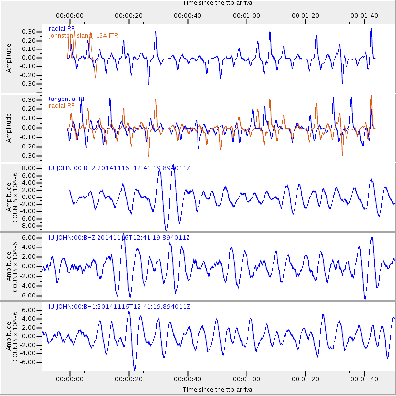
JOHN Johnston Island, USA - Earthquake Result Viewer
*The percent match for this event was below the threshold and hence no stack was calculated.
| Earthquake location: |
Northern Molucca Sea |
| Earthquake latitude/longitude: |
1.9/126.6 |
| Earthquake time(UTC): |
2014/11/16 (320) 12:31:13 GMT |
| Earthquake Depth: |
5.1 km |
| Earthquake Magnitude: |
4.8 mb, 4.7 mb, 3.6 MS |
| Earthquake Catalog/Contributor: |
ISC/ISC |
|
| Network: |
IU Global Seismograph Network (GSN - IRIS/USGS) |
| Station: |
JOHN Johnston Island, USA |
| Lat/Lon: |
16.73 N/169.53 W |
| Elevation: |
2.0 m |
|
| Distance: |
64.5 deg |
| Az: |
72.432 deg |
| Baz: |
263.956 deg |
| Ray Param: |
$rayparam |
*The percent match for this event was below the threshold and hence was not used in the summary stack. |
|
| Radial Match: |
43.787807 % |
| Radial Bump: |
300 |
| Transverse Match: |
58.60236 % |
| Transverse Bump: |
400 |
| SOD ConfigId: |
3390531 |
| Insert Time: |
2019-04-15 01:08:33.156 +0000 |
| GWidth: |
2.5 |
| Max Bumps: |
400 |
| Tol: |
0.001 |
|
Signal To Noise
| Channel | StoN | STA | LTA |
| IU:JOHN:00:BHZ:20141116T12:41:19.894011Z | 0.2652824 | 5.990641E-7 | 2.2582128E-6 |
| IU:JOHN:00:BH1:20141116T12:41:19.894011Z | 0.39153337 | 9.710424E-7 | 2.4801013E-6 |
| IU:JOHN:00:BH2:20141116T12:41:19.894011Z | 3.3924615 | 5.8240275E-6 | 1.7167556E-6 |
| Arrivals |
| Ps | |
| PpPs | |
| PsPs/PpSs | |


