CLF Chambon la Foret observatory, France - Earthquake Result Viewer
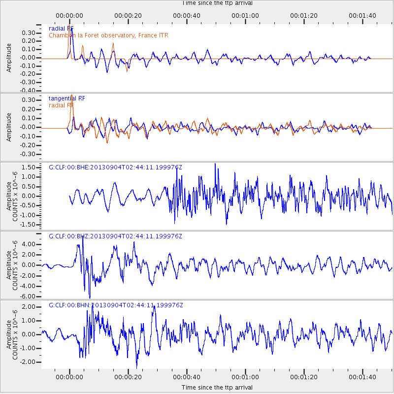
Earthquake location: Andreanof Islands, Aleutian Is.
Earthquake latitude/longitude: 51.6/-174.8
Earthquake time(UTC): 2013/09/04 (247) 02:32:30 GMT
Earthquake Depth: 20 km
Earthquake Magnitude: 6.5 MWW, 5.9 ML, 6.3 MWB, 6.5 MI, 6.5 MWC, 6.5 MWW
Earthquake Catalog/Contributor: NEIC PDE/NEIC COMCAT
Network: G GEOSCOPE
Station: CLF Chambon la Foret observatory, France
Lat/Lon: 48.03 N/2.26 E
Elevation: 145 m
Distance: 80.8 deg
Az: 2.021 deg
Baz: 358.12 deg
Ray Param: 0.04803835
Estimated Moho Depth: 10.5 km
Estimated Crust Vp/Vs: 1.62
Assumed Crust Vp: 6.12 km/s
Estimated Crust Vs: 3.789 km/s
Estimated Crust Poisson's Ratio: 0.19
Radial Match: 83.43066 %
Radial Bump: 400
Transverse Match: 75.84695 %
Transverse Bump: 400
SOD ConfigId: 626651
Insert Time: 2014-04-18 09:54:44.506 +0000
GWidth: 2.5
Max Bumps: 400
Tol: 0.001

Signal To Noise

ChannelStoNSTALTA
G:CLF:00:BHZ:20130904T02:44:11.199976Z9.3744962.1415353E-62.284427E-7
G:CLF:00:BHN:20130904T02:44:11.199976Z2.8657986.165339E-72.1513516E-7
G:CLF:00:BHE:20130904T02:44:11.199976Z0.97936963.080395E-73.1452836E-7
Arrivals
Ps1.1 SECOND
PpPs4.4 SECOND
PsPs/PpSs5.4 SECOND