TBLG Delisi, Georgia - Earthquake Result Viewer
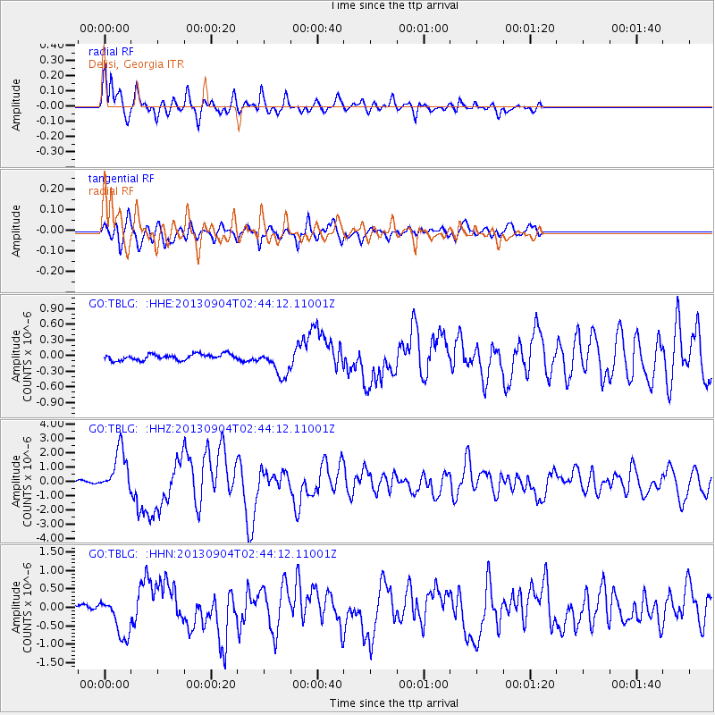
Earthquake location: Andreanof Islands, Aleutian Is.
Earthquake latitude/longitude: 51.6/-174.8
Earthquake time(UTC): 2013/09/04 (247) 02:32:30 GMT
Earthquake Depth: 20 km
Earthquake Magnitude: 6.5 MWW, 5.9 ML, 6.3 MWB, 6.5 MI, 6.5 MWC, 6.5 MWW
Earthquake Catalog/Contributor: NEIC PDE/NEIC COMCAT
Network: GO National Seismic Network of Georgia
Station: TBLG Delisi, Georgia
Lat/Lon: 41.73 N/44.74 E
Elevation: 510 m
Distance: 80.9 deg
Az: 331.173 deg
Baz: 23.713 deg
Ray Param: 0.047919594
Estimated Moho Depth: 32.75 km
Estimated Crust Vp/Vs: 2.10
Assumed Crust Vp: 6.291 km/s
Estimated Crust Vs: 2.999 km/s
Estimated Crust Poisson's Ratio: 0.35
Radial Match: 90.31849 %
Radial Bump: 400
Transverse Match: 84.26897 %
Transverse Bump: 400
SOD ConfigId: 626651
Insert Time: 2014-04-18 09:56:28.263 +0000
GWidth: 2.5
Max Bumps: 400
Tol: 0.001

Signal To Noise

ChannelStoNSTALTA
GO:TBLG: :HHZ:20130904T02:44:12.11001Z21.3530241.5352416E-67.1898086E-8
GO:TBLG: :HHN:20130904T02:44:12.11001Z7.29453755.42526E-77.437428E-8
GO:TBLG: :HHE:20130904T02:44:12.11001Z4.47220372.5667399E-75.739318E-8
Arrivals
Ps5.8 SECOND
PpPs16 SECOND
PsPs/PpSs22 SECOND