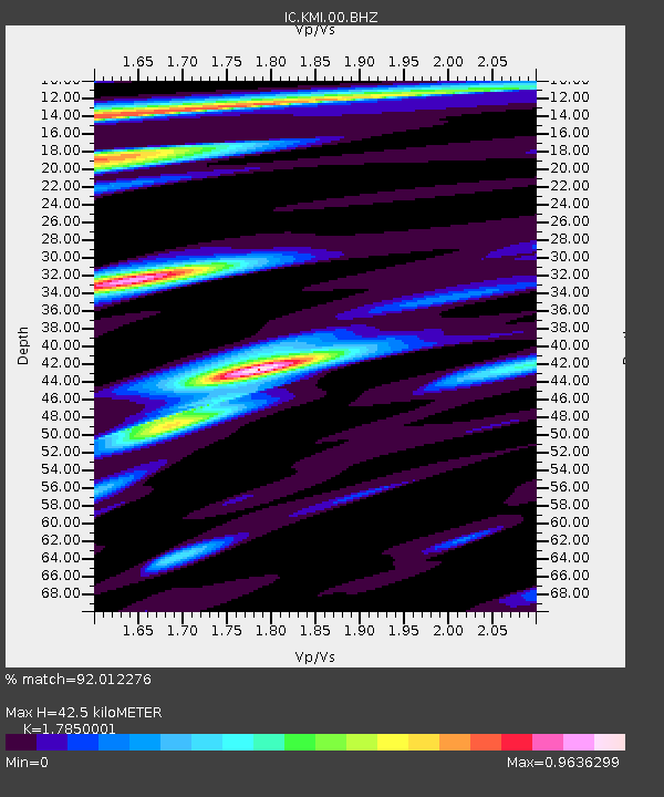
KMI Kunming, Yunnan Province, China - Earthquake Result Viewer
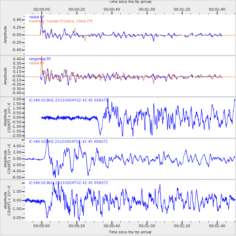
Earthquake location: Andreanof Islands, Aleutian Is.
Earthquake latitude/longitude: 51.6/-174.8
Earthquake time(UTC): 2013/09/04 (247) 02:32:30 GMT
Earthquake Depth: 20 km
Earthquake Magnitude: 6.5 MWW, 5.9 ML, 6.3 MWB, 6.5 MI, 6.5 MWC, 6.5 MWW
Earthquake Catalog/Contributor: NEIC PDE/NEIC COMCAT
Network: IC New China Digital Seismograph Network
Station: KMI Kunming, Yunnan Province, China
Lat/Lon: 25.12 N/102.74 E
Elevation: 1975 m
Distance: 66.2 deg
Az: 280.778 deg
Baz: 42.574 deg
Ray Param: 0.057760723
Estimated Moho Depth: 42.5 km
Estimated Crust Vp/Vs: 1.79
Assumed Crust Vp: 6.247 km/s
Estimated Crust Vs: 3.499 km/s
Estimated Crust Poisson's Ratio: 0.27
Radial Match: 92.012276 %
Radial Bump: 400
Transverse Match: 85.18886 %
Transverse Bump: 400
SOD ConfigId: 626651
Insert Time: 2014-04-18 09:57:32.030 +0000
GWidth: 2.5
Max Bumps: 400
Tol: 0.001

Signal To Noise

ChannelStoNSTALTA
IC:KMI:00:BHZ:20130904T02:42:45.66897Z28.8431992.7001827E-69.361592E-8
IC:KMI:00:BH1:20130904T02:42:45.66897Z7.96972048.6739186E-71.0883592E-7
IC:KMI:00:BH2:20130904T02:42:45.66897Z8.1556918.4841065E-71.04026824E-7
Arrivals
Ps5.5 SECOND
PpPs18 SECOND
PsPs/PpSs24 SECOND