
LSA Tibet, China - Earthquake Result Viewer
| ||||||||||||||||||
| ||||||||||||||||||
| ||||||||||||||||||
|
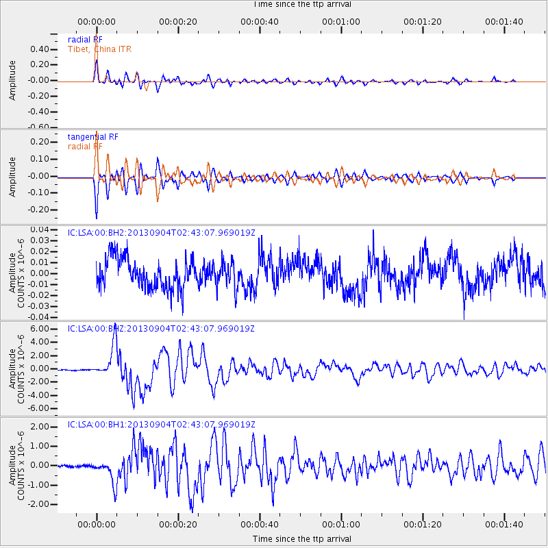
Signal To Noise
| Channel | StoN | STA | LTA |
| IC:LSA:00:BHZ:20130904T02:43:07.969019Z | 43.17308 | 2.6100338E-6 | 6.045512E-8 |
| IC:LSA:00:BH1:20130904T02:43:07.969019Z | 14.540716 | 6.330951E-7 | 4.3539476E-8 |
| IC:LSA:00:BH2:20130904T02:43:07.969019Z | 0.8879447 | 1.197041E-8 | 1.3481031E-8 |
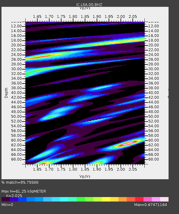
| Arrivals | |
| Ps | 10.0 SECOND |
| PpPs | 28 SECOND |
| PsPs/PpSs | 37 SECOND |

