WMQ Urumqi, Xinjiang Province, China - Earthquake Result Viewer
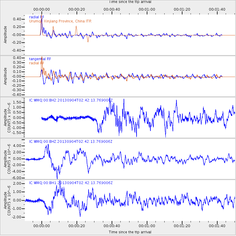
Earthquake location: Andreanof Islands, Aleutian Is.
Earthquake latitude/longitude: 51.6/-174.8
Earthquake time(UTC): 2013/09/04 (247) 02:32:30 GMT
Earthquake Depth: 20 km
Earthquake Magnitude: 6.5 MWW, 5.9 ML, 6.3 MWB, 6.5 MI, 6.5 MWC, 6.5 MWW
Earthquake Catalog/Contributor: NEIC PDE/NEIC COMCAT
Network: IC New China Digital Seismograph Network
Station: WMQ Urumqi, Xinjiang Province, China
Lat/Lon: 43.81 N/87.70 E
Elevation: 850 m
Distance: 61.3 deg
Az: 305.121 deg
Baz: 44.86 deg
Ray Param: 0.060918573
Estimated Moho Depth: 15.25 km
Estimated Crust Vp/Vs: 1.92
Assumed Crust Vp: 6.242 km/s
Estimated Crust Vs: 3.247 km/s
Estimated Crust Poisson's Ratio: 0.31
Radial Match: 97.00144 %
Radial Bump: 400
Transverse Match: 84.752884 %
Transverse Bump: 400
SOD ConfigId: 626651
Insert Time: 2014-04-18 09:57:42.439 +0000
GWidth: 2.5
Max Bumps: 400
Tol: 0.001

Signal To Noise

ChannelStoNSTALTA
IC:WMQ:00:BHZ:20130904T02:42:13.769006Z22.325762.299316E-61.0298938E-7
IC:WMQ:00:BH1:20130904T02:42:13.769006Z6.8364247.3192604E-71.0706271E-7
IC:WMQ:00:BH2:20130904T02:42:13.769006Z6.7007927.415528E-71.1066645E-7
Arrivals
Ps2.3 SECOND
PpPs6.9 SECOND
PsPs/PpSs9.2 SECOND