You are here: Home > Network List > II - Global Seismograph Network (GSN - IRIS/IDA) Stations List
> Station CMLA Cha de Macela, Sao Miguel Island, Azores > Earthquake Result Viewer
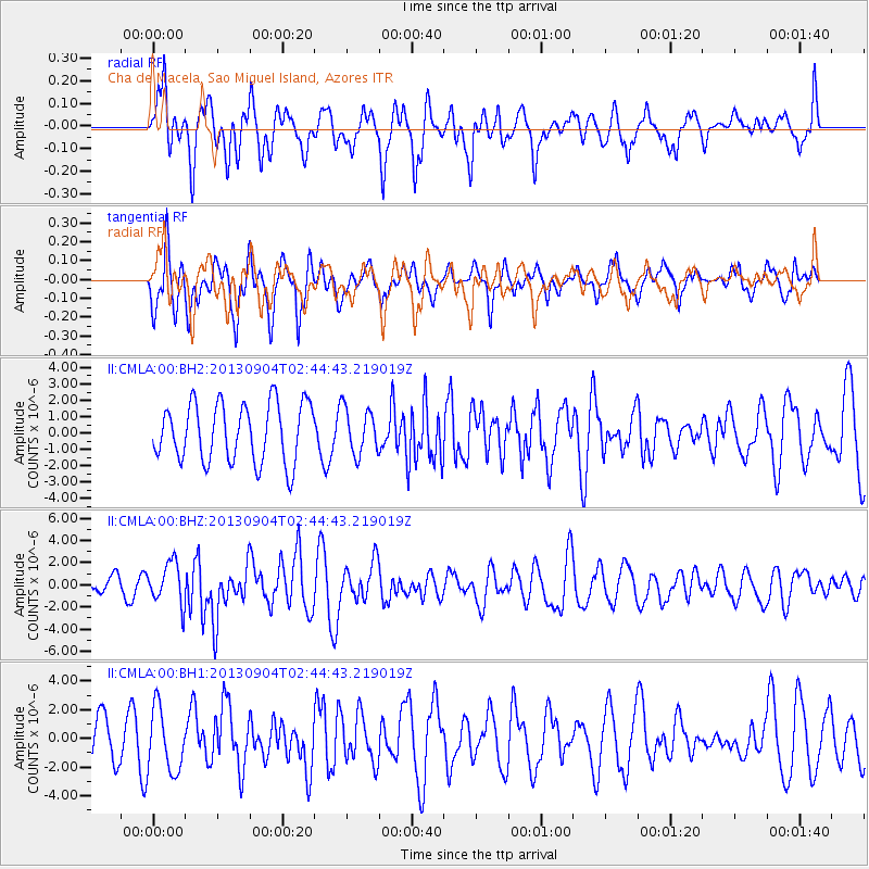
CMLA Cha de Macela, Sao Miguel Island, Azores - Earthquake Result Viewer
*The percent match for this event was below the threshold and hence no stack was calculated.
| Earthquake location: |
Andreanof Islands, Aleutian Is. |
| Earthquake latitude/longitude: |
51.6/-174.8 |
| Earthquake time(UTC): |
2013/09/04 (247) 02:32:30 GMT |
| Earthquake Depth: |
20 km |
| Earthquake Magnitude: |
6.5 MWW, 5.9 ML, 6.3 MWB, 6.5 MI, 6.5 MWC, 6.5 MWW |
| Earthquake Catalog/Contributor: |
NEIC PDE/NEIC COMCAT |
|
| Network: |
II Global Seismograph Network (GSN - IRIS/IDA) |
| Station: |
CMLA Cha de Macela, Sao Miguel Island, Azores |
| Lat/Lon: |
37.76 N/25.52 W |
| Elevation: |
429 m |
|
| Distance: |
87.1 deg |
| Az: |
23.943 deg |
| Baz: |
341.356 deg |
| Ray Param: |
$rayparam |
*The percent match for this event was below the threshold and hence was not used in the summary stack. |
|
| Radial Match: |
47.47791 % |
| Radial Bump: |
400 |
| Transverse Match: |
72.39531 % |
| Transverse Bump: |
400 |
| SOD ConfigId: |
626651 |
| Insert Time: |
2014-04-18 09:57:59.576 +0000 |
| GWidth: |
2.5 |
| Max Bumps: |
400 |
| Tol: |
0.001 |
|
Signal To Noise
| Channel | StoN | STA | LTA |
| II:CMLA:00:BHZ:20130904T02:44:43.219019Z | 2.508226 | 1.8759749E-6 | 7.47929E-7 |
| II:CMLA:00:BH1:20130904T02:44:43.219019Z | 1.4471865 | 2.2071833E-6 | 1.5251547E-6 |
| II:CMLA:00:BH2:20130904T02:44:43.219019Z | 0.7866826 | 1.4036879E-6 | 1.7843129E-6 |
| Arrivals |
| Ps | |
| PpPs | |
| PsPs/PpSs | |


