
UTMT Martin, TN - Earthquake Result Viewer
| ||||||||||||||||||
| ||||||||||||||||||
| ||||||||||||||||||
|
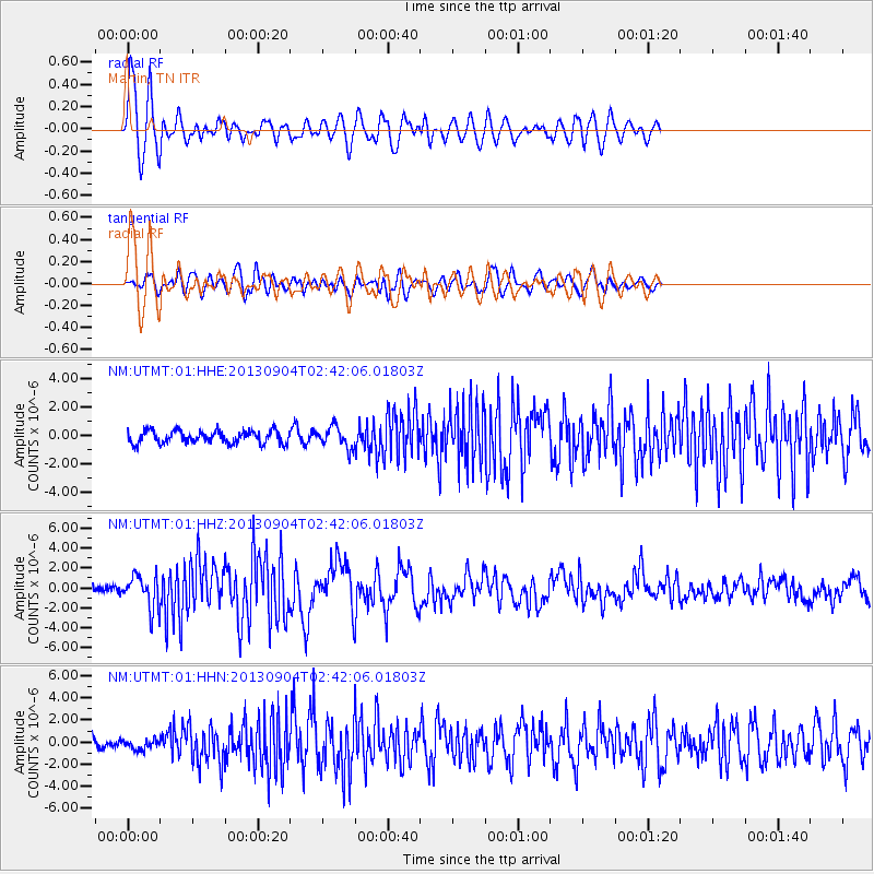
Signal To Noise
| Channel | StoN | STA | LTA |
| NM:UTMT:01:HHZ:20130904T02:42:06.01803Z | 5.5769534 | 1.6160047E-6 | 2.8976478E-7 |
| NM:UTMT:01:HHN:20130904T02:42:06.01803Z | 0.81124526 | 4.4485836E-7 | 5.483648E-7 |
| NM:UTMT:01:HHE:20130904T02:42:06.01803Z | 1.7028075 | 7.469081E-7 | 4.386333E-7 |
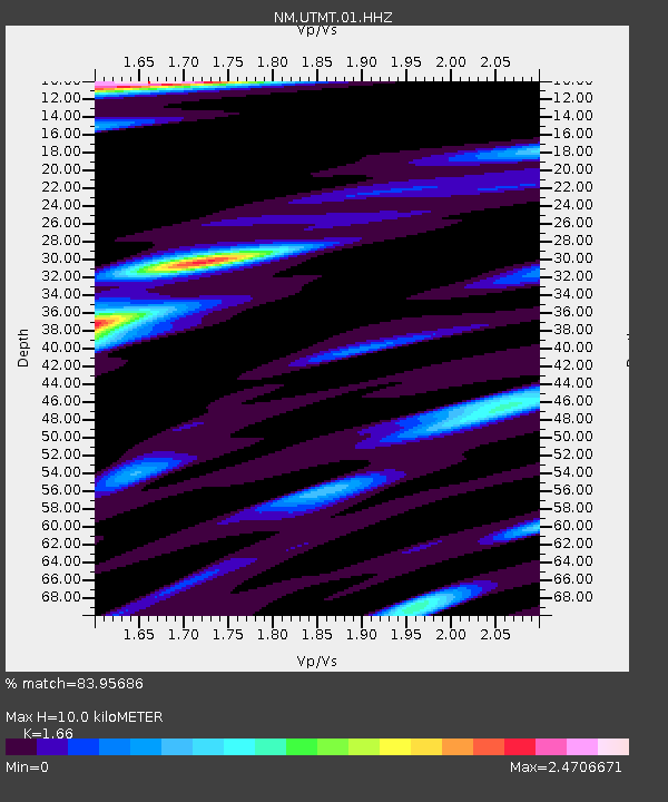
| Arrivals | |
| Ps | 1.1 SECOND |
| PpPs | 3.9 SECOND |
| PsPs/PpSs | 5.0 SECOND |

