
PAGS PA Geological Survey - Earthquake Result Viewer
| ||||||||||||||||||
| ||||||||||||||||||
| ||||||||||||||||||
|
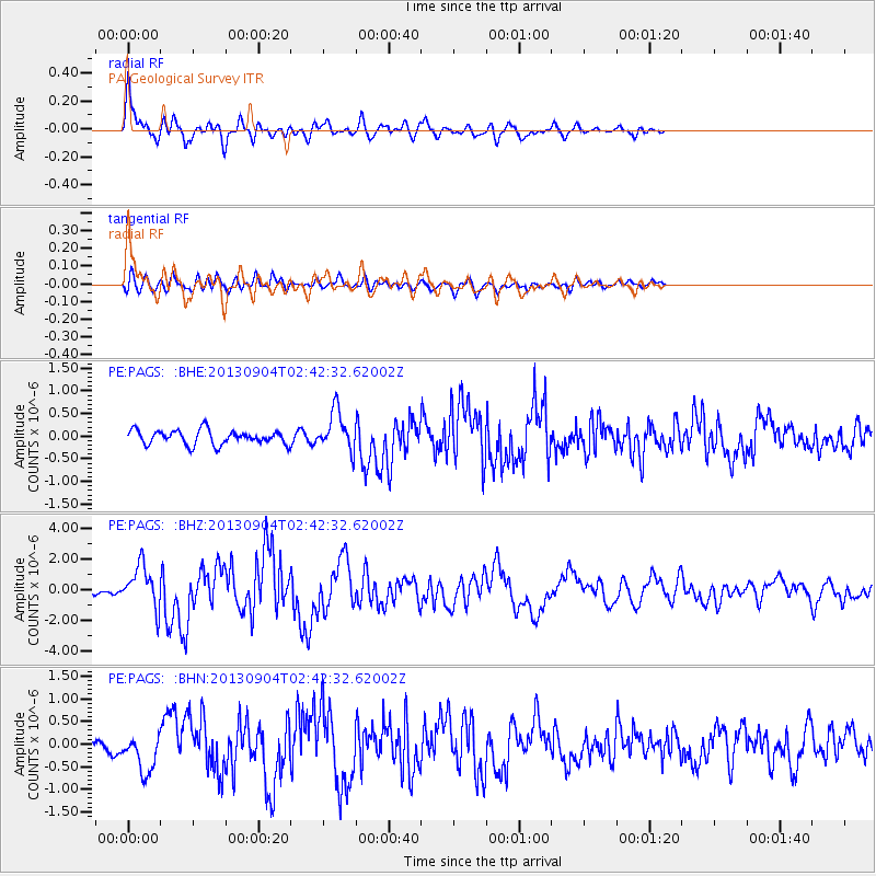
Signal To Noise
| Channel | StoN | STA | LTA |
| PE:PAGS: :BHZ:20130904T02:42:32.62002Z | 8.18563 | 1.3780848E-6 | 1.6835416E-7 |
| PE:PAGS: :BHN:20130904T02:42:32.62002Z | 3.107303 | 4.324928E-7 | 1.3918593E-7 |
| PE:PAGS: :BHE:20130904T02:42:32.62002Z | 2.7721605 | 4.3356297E-7 | 1.5639894E-7 |
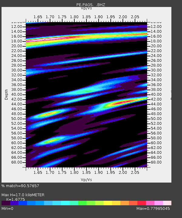
| Arrivals | |
| Ps | 2.0 SECOND |
| PpPs | 7.1 SECOND |
| PsPs/PpSs | 9.1 SECOND |

