
153A Fort Valley, GA, USA - Earthquake Result Viewer
| ||||||||||||||||||
| ||||||||||||||||||
| ||||||||||||||||||
|
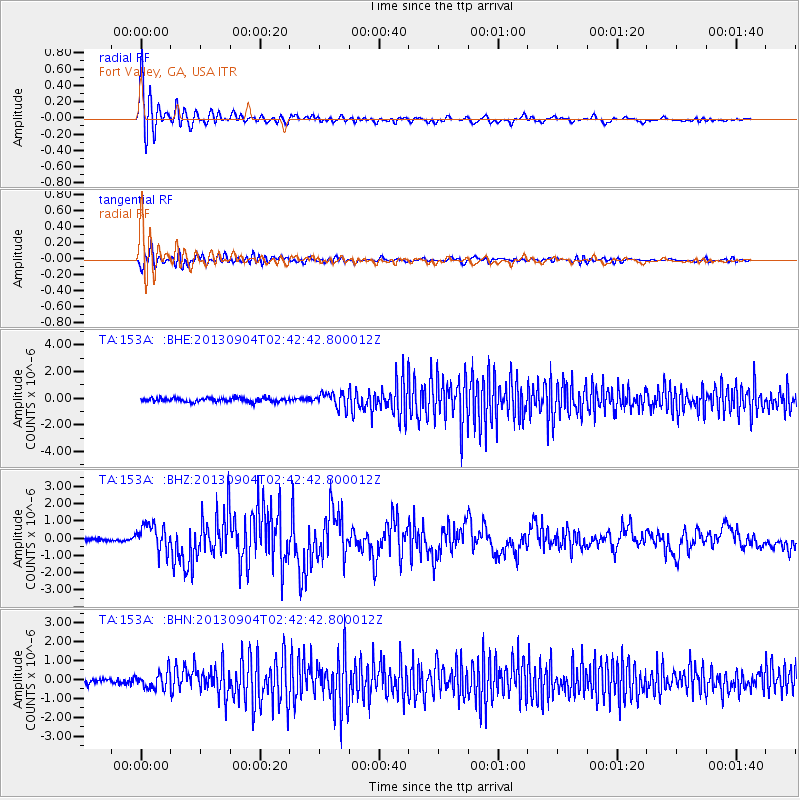
Signal To Noise
| Channel | StoN | STA | LTA |
| TA:153A: :BHZ:20130904T02:42:42.800012Z | 7.378521 | 7.828049E-7 | 1.06092386E-7 |
| TA:153A: :BHN:20130904T02:42:42.800012Z | 3.2400212 | 4.5137247E-7 | 1.3931157E-7 |
| TA:153A: :BHE:20130904T02:42:42.800012Z | 3.6419153 | 5.3941966E-7 | 1.4811428E-7 |
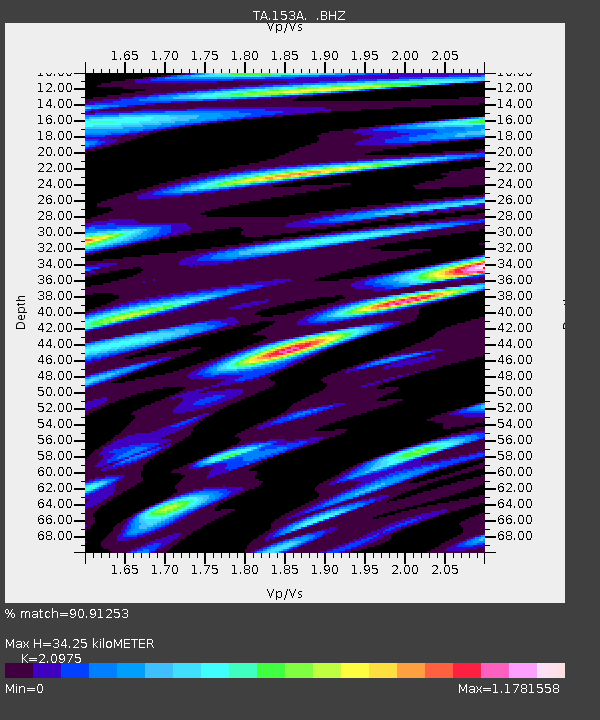
| Arrivals | |
| Ps | 5.9 SECOND |
| PpPs | 16 SECOND |
| PsPs/PpSs | 22 SECOND |

