157A Early Branch, SC, USA - Earthquake Result Viewer
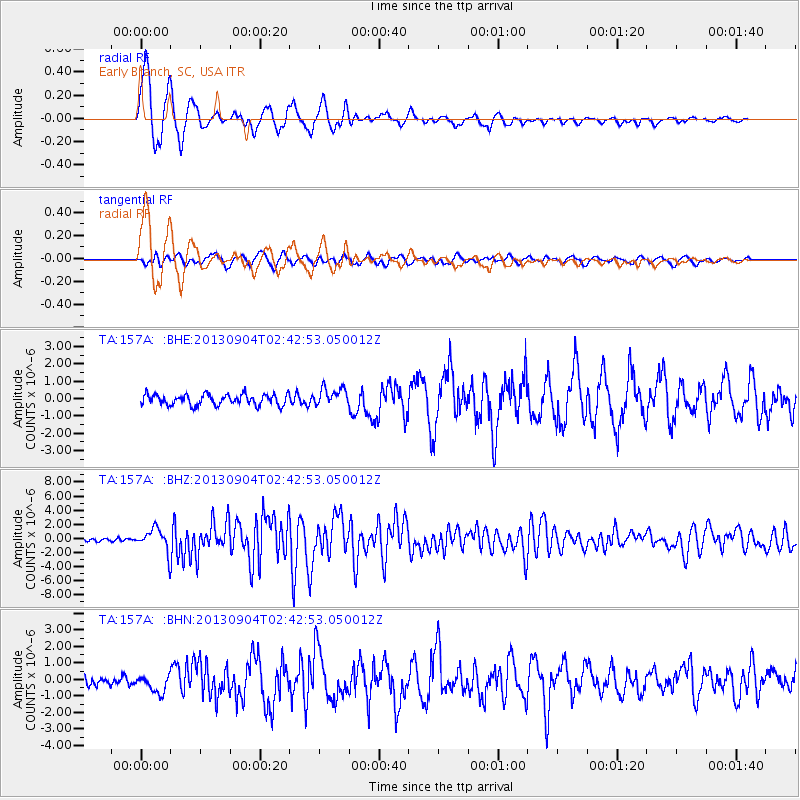
Earthquake location: Andreanof Islands, Aleutian Is.
Earthquake latitude/longitude: 51.6/-174.8
Earthquake time(UTC): 2013/09/04 (247) 02:32:30 GMT
Earthquake Depth: 20 km
Earthquake Magnitude: 6.5 MWW, 5.9 ML, 6.3 MWB, 6.5 MI, 6.5 MWC, 6.5 MWW
Earthquake Catalog/Contributor: NEIC PDE/NEIC COMCAT
Network: TA USArray Transportable Network (new EarthScope stations)
Station: 157A Early Branch, SC, USA
Lat/Lon: 32.68 N/81.00 W
Elevation: 21 m
Distance: 67.3 deg
Az: 65.767 deg
Baz: 317.544 deg
Ray Param: 0.056995332
Estimated Moho Depth: 13.75 km
Estimated Crust Vp/Vs: 1.66
Assumed Crust Vp: 6.565 km/s
Estimated Crust Vs: 3.943 km/s
Estimated Crust Poisson's Ratio: 0.22
Radial Match: 94.29647 %
Radial Bump: 359
Transverse Match: 70.270905 %
Transverse Bump: 400
SOD ConfigId: 626651
Insert Time: 2014-04-18 10:09:33.798 +0000
GWidth: 2.5
Max Bumps: 400
Tol: 0.001

Signal To Noise

ChannelStoNSTALTA
TA:157A: :BHZ:20130904T02:42:53.050012Z8.6722621.6279961E-61.8772451E-7
TA:157A: :BHN:20130904T02:42:53.050012Z1.69471925.3678895E-73.1674213E-7
TA:157A: :BHE:20130904T02:42:53.050012Z1.68066645.215205E-73.1030578E-7
Arrivals
Ps1.5 SECOND
PpPs5.3 SECOND
PsPs/PpSs6.8 SECOND