256A Glennville, GA, USA - Earthquake Result Viewer
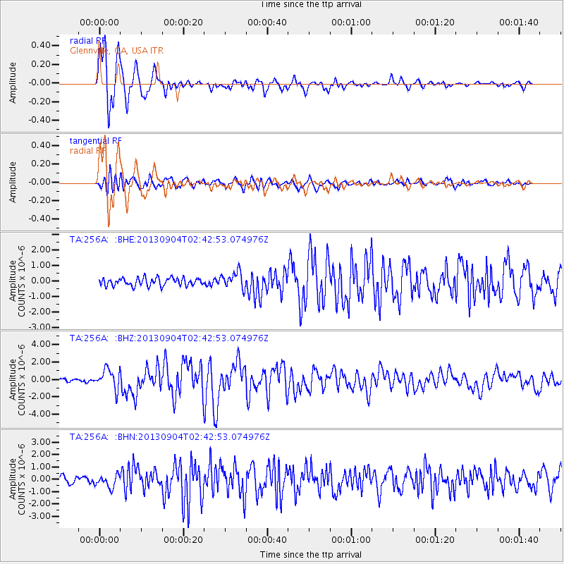
Earthquake location: Andreanof Islands, Aleutian Is.
Earthquake latitude/longitude: 51.6/-174.8
Earthquake time(UTC): 2013/09/04 (247) 02:32:30 GMT
Earthquake Depth: 20 km
Earthquake Magnitude: 6.5 MWW, 5.9 ML, 6.3 MWB, 6.5 MI, 6.5 MWC, 6.5 MWW
Earthquake Catalog/Contributor: NEIC PDE/NEIC COMCAT
Network: TA USArray Transportable Network (new EarthScope stations)
Station: 256A Glennville, GA, USA
Lat/Lon: 31.98 N/81.89 W
Elevation: 46 m
Distance: 67.4 deg
Az: 66.879 deg
Baz: 317.499 deg
Ray Param: 0.0569926
Estimated Moho Depth: 12.5 km
Estimated Crust Vp/Vs: 1.66
Assumed Crust Vp: 5.989 km/s
Estimated Crust Vs: 3.597 km/s
Estimated Crust Poisson's Ratio: 0.22
Radial Match: 94.08965 %
Radial Bump: 400
Transverse Match: 73.23177 %
Transverse Bump: 400
SOD ConfigId: 626651
Insert Time: 2014-04-18 10:09:53.550 +0000
GWidth: 2.5
Max Bumps: 400
Tol: 0.001

Signal To Noise

ChannelStoNSTALTA
TA:256A: :BHZ:20130904T02:42:53.074976Z8.2586891.1630115E-61.4082276E-7
TA:256A: :BHN:20130904T02:42:53.074976Z2.20066555.049046E-72.2943269E-7
TA:256A: :BHE:20130904T02:42:53.074976Z2.18326435.4122626E-72.478977E-7
Arrivals
Ps1.4 SECOND
PpPs5.4 SECOND
PsPs/PpSs6.8 SECOND