352A Blakely, GA, USA - Earthquake Result Viewer
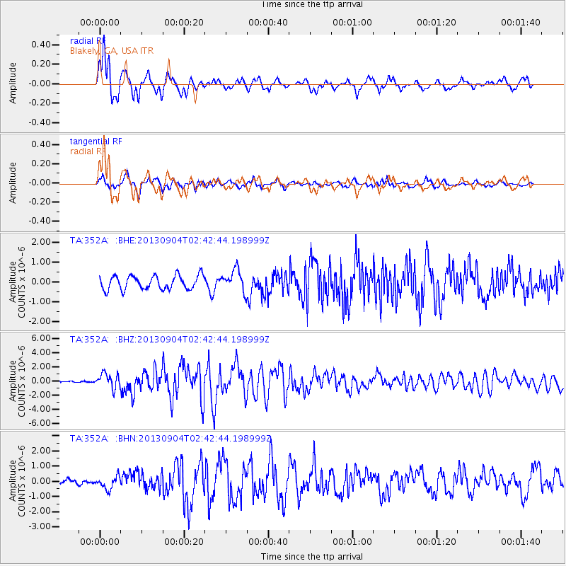
Earthquake location: Andreanof Islands, Aleutian Is.
Earthquake latitude/longitude: 51.6/-174.8
Earthquake time(UTC): 2013/09/04 (247) 02:32:30 GMT
Earthquake Depth: 20 km
Earthquake Magnitude: 6.5 MWW, 5.9 ML, 6.3 MWB, 6.5 MI, 6.5 MWC, 6.5 MWW
Earthquake Catalog/Contributor: NEIC PDE/NEIC COMCAT
Network: TA USArray Transportable Network (new EarthScope stations)
Station: 352A Blakely, GA, USA
Lat/Lon: 31.48 N/84.93 W
Elevation: 101 m
Distance: 66.0 deg
Az: 69.318 deg
Baz: 316.874 deg
Ray Param: 0.057910334
Estimated Moho Depth: 13.5 km
Estimated Crust Vp/Vs: 1.96
Assumed Crust Vp: 6.347 km/s
Estimated Crust Vs: 3.234 km/s
Estimated Crust Poisson's Ratio: 0.32
Radial Match: 90.036865 %
Radial Bump: 400
Transverse Match: 73.88345 %
Transverse Bump: 400
SOD ConfigId: 626651
Insert Time: 2014-04-18 10:09:57.932 +0000
GWidth: 2.5
Max Bumps: 400
Tol: 0.001

Signal To Noise

ChannelStoNSTALTA
TA:352A: :BHZ:20130904T02:42:44.198999Z8.3031131.0516494E-61.2665724E-7
TA:352A: :BHN:20130904T02:42:44.198999Z1.57501424.316887E-72.740856E-7
TA:352A: :BHE:20130904T02:42:44.198999Z1.62182585.612989E-73.4609073E-7
Arrivals
Ps2.1 SECOND
PpPs6.1 SECOND
PsPs/PpSs8.2 SECOND