
355A Pearson, GA, USA - Earthquake Result Viewer
| ||||||||||||||||||
| ||||||||||||||||||
| ||||||||||||||||||
|
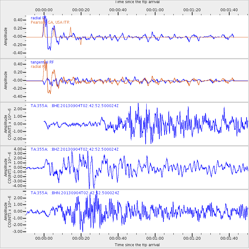
Signal To Noise
| Channel | StoN | STA | LTA |
| TA:355A: :BHZ:20130904T02:42:52.500024Z | 9.748448 | 1.0537248E-6 | 1.0809154E-7 |
| TA:355A: :BHN:20130904T02:42:52.500024Z | 1.9884119 | 3.9819164E-7 | 2.0025611E-7 |
| TA:355A: :BHE:20130904T02:42:52.500024Z | 2.4360888 | 4.839751E-7 | 1.986689E-7 |
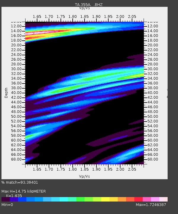
| Arrivals | |
| Ps | 1.5 SECOND |
| PpPs | 5.7 SECOND |
| PsPs/PpSs | 7.2 SECOND |

