435B Jarrell, TX, USA - Earthquake Result Viewer
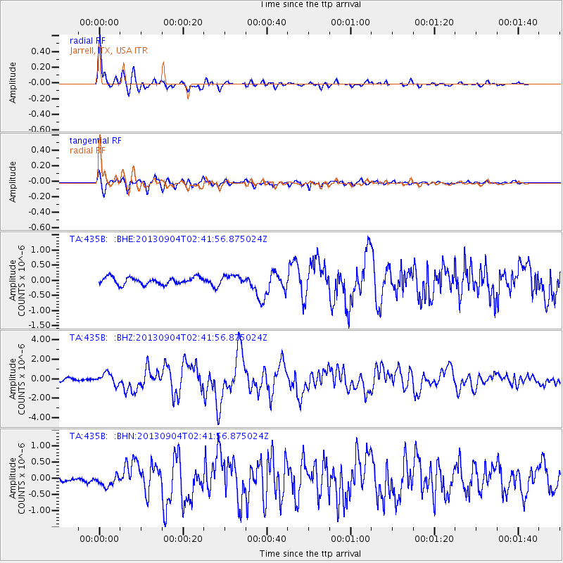
Earthquake location: Andreanof Islands, Aleutian Is.
Earthquake latitude/longitude: 51.6/-174.8
Earthquake time(UTC): 2013/09/04 (247) 02:32:30 GMT
Earthquake Depth: 20 km
Earthquake Magnitude: 6.5 MWW, 5.9 ML, 6.3 MWB, 6.5 MI, 6.5 MWC, 6.5 MWW
Earthquake Catalog/Contributor: NEIC PDE/NEIC COMCAT
Network: TA USArray Transportable Network (new EarthScope stations)
Station: 435B Jarrell, TX, USA
Lat/Lon: 30.78 N/97.58 W
Elevation: 248 m
Distance: 58.9 deg
Az: 78.629 deg
Baz: 314.671 deg
Ray Param: 0.062541425
Estimated Moho Depth: 14.75 km
Estimated Crust Vp/Vs: 1.60
Assumed Crust Vp: 6.347 km/s
Estimated Crust Vs: 3.967 km/s
Estimated Crust Poisson's Ratio: 0.18
Radial Match: 94.64247 %
Radial Bump: 377
Transverse Match: 89.17817 %
Transverse Bump: 400
SOD ConfigId: 626651
Insert Time: 2014-04-18 10:10:09.457 +0000
GWidth: 2.5
Max Bumps: 400
Tol: 0.001

Signal To Noise

ChannelStoNSTALTA
TA:435B: :BHZ:20130904T02:41:56.875024Z5.0552885.8041877E-71.1481419E-7
TA:435B: :BHN:20130904T02:41:56.875024Z2.5653041.8009122E-77.020268E-8
TA:435B: :BHE:20130904T02:41:56.875024Z1.24420011.4624258E-71.17539436E-7
Arrivals
Ps1.5 SECOND
PpPs5.7 SECOND
PsPs/PpSs7.2 SECOND