656A Willston, FL, USA - Earthquake Result Viewer
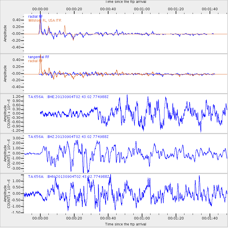
Earthquake location: Andreanof Islands, Aleutian Is.
Earthquake latitude/longitude: 51.6/-174.8
Earthquake time(UTC): 2013/09/04 (247) 02:32:30 GMT
Earthquake Depth: 20 km
Earthquake Magnitude: 6.5 MWW, 5.9 ML, 6.3 MWB, 6.5 MI, 6.5 MWC, 6.5 MWW
Earthquake Catalog/Contributor: NEIC PDE/NEIC COMCAT
Network: TA USArray Transportable Network (new EarthScope stations)
Station: 656A Willston, FL, USA
Lat/Lon: 29.37 N/82.53 W
Elevation: 28 m
Distance: 68.9 deg
Az: 69.209 deg
Baz: 318.038 deg
Ray Param: 0.055979062
Estimated Moho Depth: 35.0 km
Estimated Crust Vp/Vs: 1.89
Assumed Crust Vp: 5.989 km/s
Estimated Crust Vs: 3.173 km/s
Estimated Crust Poisson's Ratio: 0.30
Radial Match: 96.16517 %
Radial Bump: 400
Transverse Match: 84.75638 %
Transverse Bump: 400
SOD ConfigId: 626651
Insert Time: 2014-04-18 10:10:30.287 +0000
GWidth: 2.5
Max Bumps: 400
Tol: 0.001

Signal To Noise

ChannelStoNSTALTA
TA:656A: :BHZ:20130904T02:43:02.774988Z8.0653398.876185E-71.1005347E-7
TA:656A: :BHN:20130904T02:43:02.774988Z2.99035763.0387724E-71.0161903E-7
TA:656A: :BHE:20130904T02:43:02.774988Z2.36855532.9352296E-71.2392489E-7
Arrivals
Ps5.3 SECOND
PpPs16 SECOND
PsPs/PpSs22 SECOND