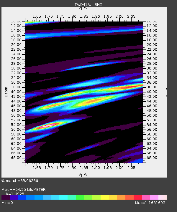
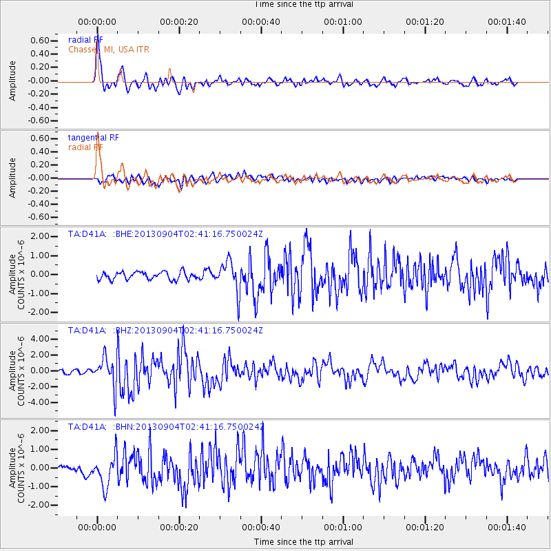
D41A Chassel, MI, USA - Earthquake Result Viewer

Earthquake location: Andreanof Islands, Aleutian Is.
Earthquake latitude/longitude: 51.6/-174.8
Earthquake time(UTC): 2013/09/04 (247) 02:32:30 GMT
Earthquake Depth: 20 km
Earthquake Magnitude: 6.5 MWW, 5.9 ML, 6.3 MWB, 6.5 MI, 6.5 MWC, 6.5 MWW
Earthquake Catalog/Contributor: NEIC PDE/NEIC COMCAT
Network: TA USArray Transportable Network (new EarthScope stations)
Station: D41A Chassel, MI, USA
Lat/Lon: 47.06 N/88.57 W
Elevation: 271 m
Distance: 53.2 deg
Az: 58.367 deg
Baz: 308.97 deg
Ray Param: 0.066203475
Estimated Moho Depth: 54.25 km
Estimated Crust Vp/Vs: 1.69
Assumed Crust Vp: 6.467 km/s
Estimated Crust Vs: 3.821 km/s
Estimated Crust Poisson's Ratio: 0.23
Radial Match: 89.06366 %
Radial Bump: 400
Transverse Match: 67.75495 %
Transverse Bump: 400
SOD ConfigId: 626651
Insert Time: 2014-04-18 10:11:01.186 +0000
GWidth: 2.5
Max Bumps: 400
Tol: 0.001

Signal To Noise

ChannelStoNSTALTA
TA:D41A: :BHZ:20130904T02:41:16.750024Z8.1627941.8811278E-62.3045146E-7
TA:D41A: :BHN:20130904T02:41:16.750024Z3.23769648.9774585E-72.7727918E-7
TA:D41A: :BHE:20130904T02:41:16.750024Z4.25740158.5250275E-72.0024018E-7
Arrivals
Ps6.2 SECOND
PpPs21 SECOND
PsPs/PpSs27 SECOND