D50A G1974 Best Township, ON, CAN - Earthquake Result Viewer
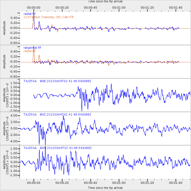
Earthquake location: Andreanof Islands, Aleutian Is.
Earthquake latitude/longitude: 51.6/-174.8
Earthquake time(UTC): 2013/09/04 (247) 02:32:30 GMT
Earthquake Depth: 20 km
Earthquake Magnitude: 6.5 MWW, 5.9 ML, 6.3 MWB, 6.5 MI, 6.5 MWC, 6.5 MWW
Earthquake Catalog/Contributor: NEIC PDE/NEIC COMCAT
Network: TA USArray Transportable Network (new EarthScope stations)
Station: D50A G1974 Best Township, ON, CAN
Lat/Lon: 47.17 N/79.84 W
Elevation: 331 m
Distance: 57.7 deg
Az: 53.547 deg
Baz: 312.613 deg
Ray Param: 0.063308194
Estimated Moho Depth: 34.5 km
Estimated Crust Vp/Vs: 1.70
Assumed Crust Vp: 6.622 km/s
Estimated Crust Vs: 3.895 km/s
Estimated Crust Poisson's Ratio: 0.24
Radial Match: 90.20026 %
Radial Bump: 400
Transverse Match: 59.335117 %
Transverse Bump: 400
SOD ConfigId: 626651
Insert Time: 2014-04-18 10:11:10.820 +0000
GWidth: 2.5
Max Bumps: 400
Tol: 0.001

Signal To Noise

ChannelStoNSTALTA
TA:D50A: :BHZ:20130904T02:41:48.649988Z10.3063451.6643304E-61.61486E-7
TA:D50A: :BHN:20130904T02:41:48.649988Z3.78438575.8030815E-71.5334277E-7
TA:D50A: :BHE:20130904T02:41:48.649988Z4.421636.8210846E-71.542663E-7
Arrivals
Ps3.9 SECOND
PpPs13 SECOND
PsPs/PpSs17 SECOND