
D58A Chemin du LacGrosbois, Trois-Rives, QC, CAN - Earthquake Result Viewer
| ||||||||||||||||||
| ||||||||||||||||||
| ||||||||||||||||||
|
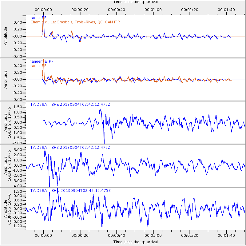
Signal To Noise
| Channel | StoN | STA | LTA |
| TA:D58A: :BHZ:20130904T02:42:12.475Z | 7.5790763 | 1.7037272E-6 | 2.2479351E-7 |
| TA:D58A: :BHN:20130904T02:42:12.475Z | 4.276534 | 5.2737704E-7 | 1.233188E-7 |
| TA:D58A: :BHE:20130904T02:42:12.475Z | 5.0040216 | 7.968244E-7 | 1.592368E-7 |
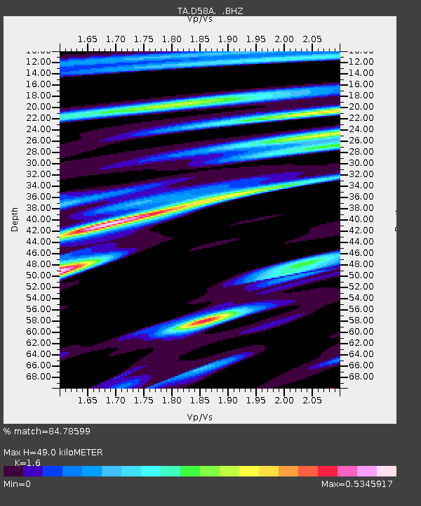
| Arrivals | |
| Ps | 4.7 SECOND |
| PpPs | 18 SECOND |
| PsPs/PpSs | 23 SECOND |

