
E44A Grand Marais Airport, Grand Marais, MI, USA - Earthquake Result Viewer
| ||||||||||||||||||
| ||||||||||||||||||
| ||||||||||||||||||
|
Signal To Noise
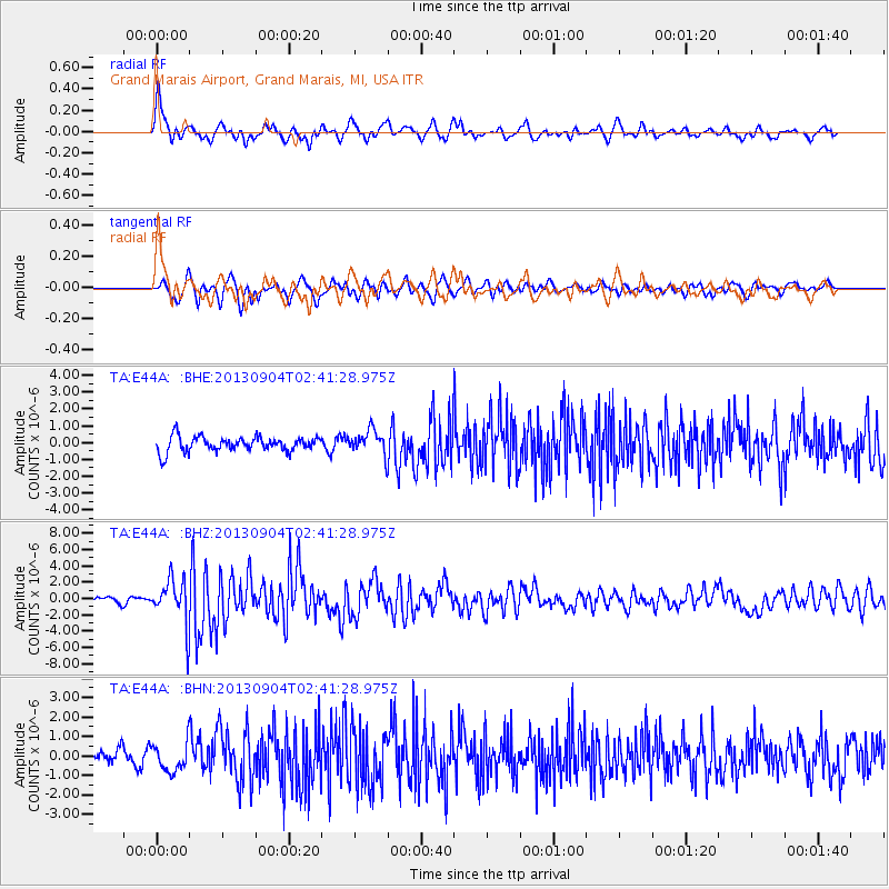
| Channel | StoN | STA | LTA |
| TA:E44A: :BHZ:20130904T02:41:28.975Z | 8.531582 | 2.7824906E-6 | 3.2614005E-7 |
| TA:E44A: :BHN:20130904T02:41:28.975Z | 2.3402624 | 7.237665E-7 | 3.0926725E-7 |
| TA:E44A: :BHE:20130904T02:41:28.975Z | 1.6371902 | 7.2897876E-7 | 4.452621E-7 |
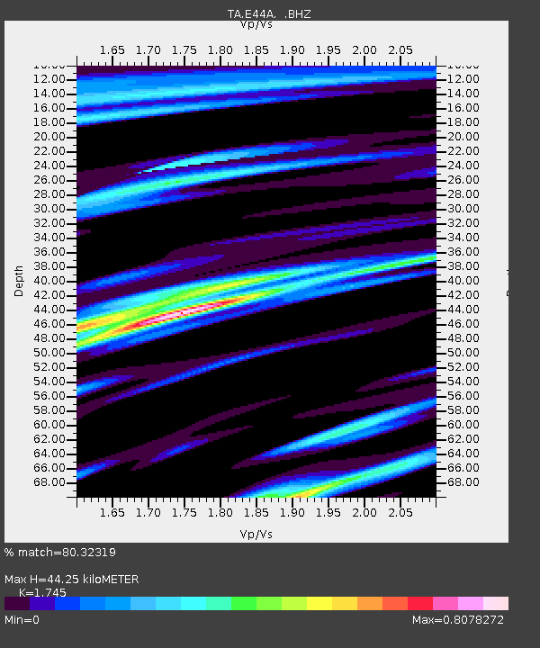
| Arrivals | |
| Ps | 5.4 SECOND |
| PpPs | 18 SECOND |
| PsPs/PpSs | 23 SECOND |

