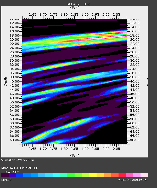
E46A Sault Ste Marie, MI, USA - Earthquake Result Viewer
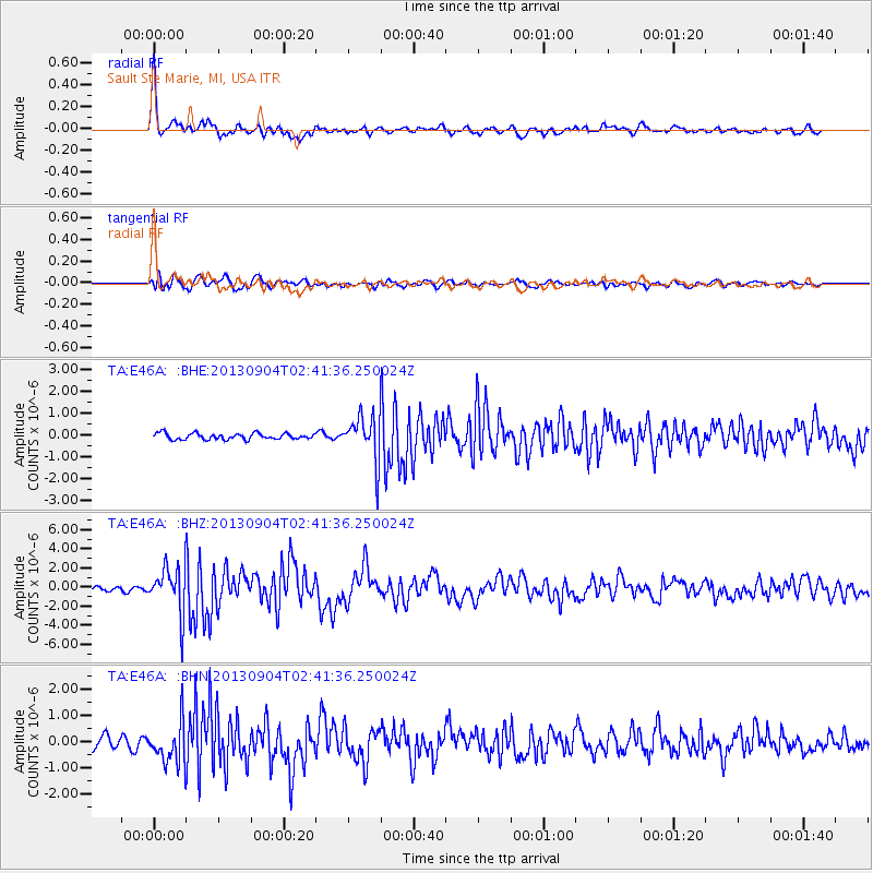
Earthquake location: Andreanof Islands, Aleutian Is.
Earthquake latitude/longitude: 51.6/-174.8
Earthquake time(UTC): 2013/09/04 (247) 02:32:30 GMT
Earthquake Depth: 20 km
Earthquake Magnitude: 6.5 MWW, 5.9 ML, 6.3 MWB, 6.5 MI, 6.5 MWC, 6.5 MWW
Earthquake Catalog/Contributor: NEIC PDE/NEIC COMCAT
Network: TA USArray Transportable Network (new EarthScope stations)
Station: E46A Sault Ste Marie, MI, USA
Lat/Lon: 46.37 N/84.31 W
Elevation: 269 m
Distance: 55.9 deg
Az: 56.706 deg
Baz: 311.099 deg
Ray Param: 0.064444885
Estimated Moho Depth: 19.0 km
Estimated Crust Vp/Vs: 1.99
Assumed Crust Vp: 6.467 km/s
Estimated Crust Vs: 3.258 km/s
Estimated Crust Poisson's Ratio: 0.33
Radial Match: 92.27039 %
Radial Bump: 400
Transverse Match: 74.99825 %
Transverse Bump: 400
SOD ConfigId: 626651
Insert Time: 2014-04-18 10:11:48.983 +0000
GWidth: 2.5
Max Bumps: 400
Tol: 0.001

Signal To Noise

ChannelStoNSTALTA
TA:E46A: :BHZ:20130904T02:41:36.250024Z15.408112.4316737E-61.5781778E-7
TA:E46A: :BHN:20130904T02:41:36.250024Z3.98790937.802572E-71.9565572E-7
TA:E46A: :BHE:20130904T02:41:36.250024Z7.32447431.0245021E-61.398738E-7
Arrivals
Ps3.0 SECOND
PpPs8.4 SECOND
PsPs/PpSs11 SECOND