E51A G1948 Merrick Township, ON, CAN - Earthquake Result Viewer
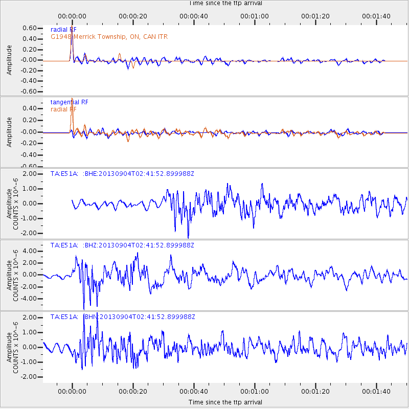
Earthquake location: Andreanof Islands, Aleutian Is.
Earthquake latitude/longitude: 51.6/-174.8
Earthquake time(UTC): 2013/09/04 (247) 02:32:30 GMT
Earthquake Depth: 20 km
Earthquake Magnitude: 6.5 MWW, 5.9 ML, 6.3 MWB, 6.5 MI, 6.5 MWC, 6.5 MWW
Earthquake Catalog/Contributor: NEIC PDE/NEIC COMCAT
Network: TA USArray Transportable Network (new EarthScope stations)
Station: E51A G1948 Merrick Township, ON, CAN
Lat/Lon: 46.53 N/79.49 W
Elevation: 369 m
Distance: 58.3 deg
Az: 53.903 deg
Baz: 313.056 deg
Ray Param: 0.06291438
Estimated Moho Depth: 10.25 km
Estimated Crust Vp/Vs: 1.81
Assumed Crust Vp: 6.622 km/s
Estimated Crust Vs: 3.664 km/s
Estimated Crust Poisson's Ratio: 0.28
Radial Match: 87.76762 %
Radial Bump: 400
Transverse Match: 68.82542 %
Transverse Bump: 400
SOD ConfigId: 626651
Insert Time: 2014-04-18 10:11:58.040 +0000
GWidth: 2.5
Max Bumps: 400
Tol: 0.001

Signal To Noise

ChannelStoNSTALTA
TA:E51A: :BHZ:20130904T02:41:52.899988Z7.6697362.0117654E-62.6229915E-7
TA:E51A: :BHN:20130904T02:41:52.899988Z3.75956157.68072E-72.042983E-7
TA:E51A: :BHE:20130904T02:41:52.899988Z4.00004346.895007E-71.7237332E-7
Arrivals
Ps1.3 SECOND
PpPs4.1 SECOND
PsPs/PpSs5.4 SECOND