F52A Sundridge, ON, CAN - Earthquake Result Viewer
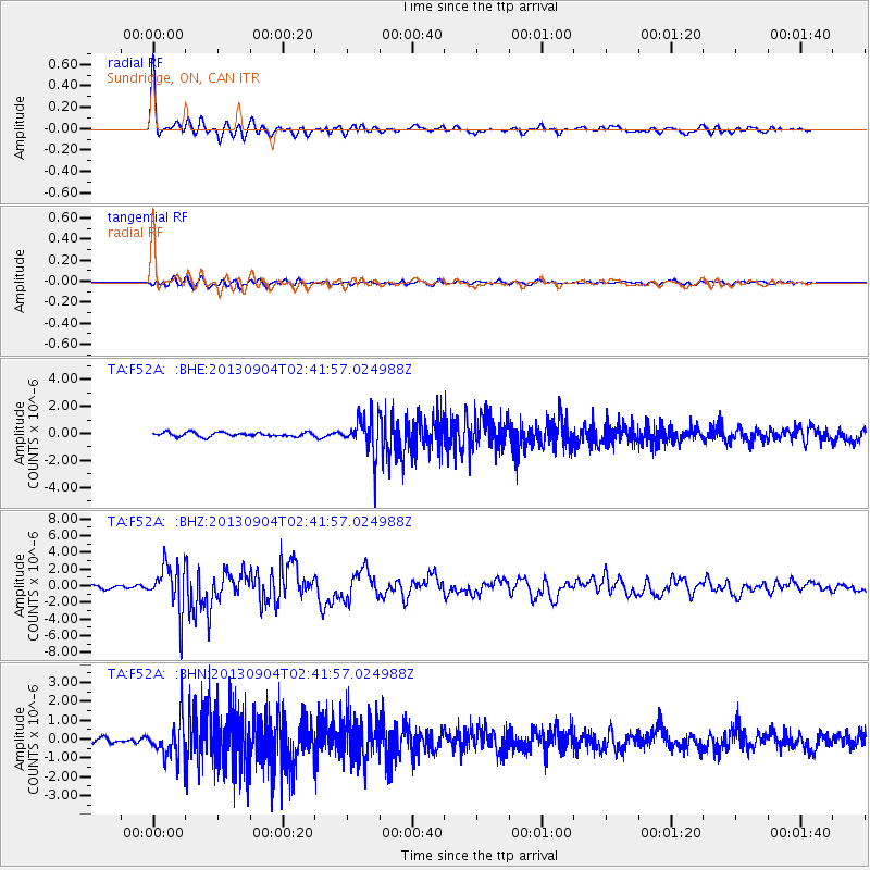
Earthquake location: Andreanof Islands, Aleutian Is.
Earthquake latitude/longitude: 51.6/-174.8
Earthquake time(UTC): 2013/09/04 (247) 02:32:30 GMT
Earthquake Depth: 20 km
Earthquake Magnitude: 6.5 MWW, 5.9 ML, 6.3 MWB, 6.5 MI, 6.5 MWC, 6.5 MWW
Earthquake Catalog/Contributor: NEIC PDE/NEIC COMCAT
Network: TA USArray Transportable Network (new EarthScope stations)
Station: F52A Sundridge, ON, CAN
Lat/Lon: 45.80 N/79.32 W
Elevation: 351 m
Distance: 58.9 deg
Az: 54.439 deg
Baz: 313.457 deg
Ray Param: 0.062528685
Estimated Moho Depth: 16.75 km
Estimated Crust Vp/Vs: 2.09
Assumed Crust Vp: 6.577 km/s
Estimated Crust Vs: 3.143 km/s
Estimated Crust Poisson's Ratio: 0.35
Radial Match: 89.4705 %
Radial Bump: 393
Transverse Match: 64.364586 %
Transverse Bump: 400
SOD ConfigId: 626651
Insert Time: 2014-04-18 10:12:37.010 +0000
GWidth: 2.5
Max Bumps: 400
Tol: 0.001

Signal To Noise

ChannelStoNSTALTA
TA:F52A: :BHZ:20130904T02:41:57.024988Z13.517242.803312E-62.073879E-7
TA:F52A: :BHN:20130904T02:41:57.024988Z6.6454841.0487324E-61.5781129E-7
TA:F52A: :BHE:20130904T02:41:57.024988Z9.3901881.4122725E-61.5039873E-7
Arrivals
Ps2.9 SECOND
PpPs7.5 SECOND
PsPs/PpSs10 SECOND