G47A Hillman, MI, USA - Earthquake Result Viewer
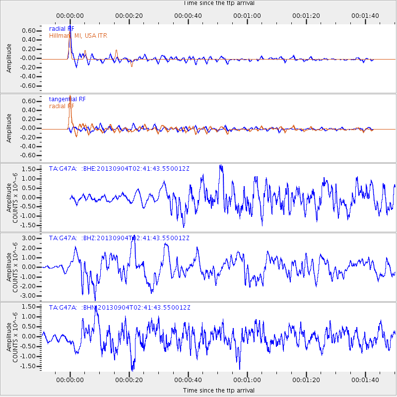
Earthquake location: Andreanof Islands, Aleutian Is.
Earthquake latitude/longitude: 51.6/-174.8
Earthquake time(UTC): 2013/09/04 (247) 02:32:30 GMT
Earthquake Depth: 20 km
Earthquake Magnitude: 6.5 MWW, 5.9 ML, 6.3 MWB, 6.5 MI, 6.5 MWC, 6.5 MWW
Earthquake Catalog/Contributor: NEIC PDE/NEIC COMCAT
Network: TA USArray Transportable Network (new EarthScope stations)
Station: G47A Hillman, MI, USA
Lat/Lon: 45.17 N/83.86 W
Elevation: 239 m
Distance: 57.0 deg
Az: 57.528 deg
Baz: 311.876 deg
Ray Param: 0.06377356
Estimated Moho Depth: 36.0 km
Estimated Crust Vp/Vs: 1.60
Assumed Crust Vp: 6.483 km/s
Estimated Crust Vs: 4.052 km/s
Estimated Crust Poisson's Ratio: 0.18
Radial Match: 89.70004 %
Radial Bump: 400
Transverse Match: 65.55046 %
Transverse Bump: 400
SOD ConfigId: 626651
Insert Time: 2014-04-18 10:13:04.729 +0000
GWidth: 2.5
Max Bumps: 400
Tol: 0.001

Signal To Noise

ChannelStoNSTALTA
TA:G47A: :BHZ:20130904T02:41:43.550012Z8.7696221.2416936E-61.415903E-7
TA:G47A: :BHN:20130904T02:41:43.550012Z2.6388325.1390015E-71.947453E-7
TA:G47A: :BHE:20130904T02:41:43.550012Z2.78012424.9407504E-71.777169E-7
Arrivals
Ps3.5 SECOND
PpPs14 SECOND
PsPs/PpSs17 SECOND