G55A Calabogie, ON, CAN - Earthquake Result Viewer
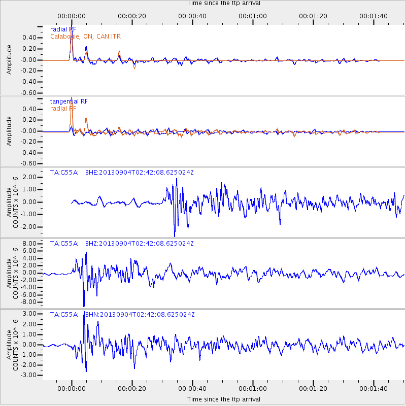
Earthquake location: Andreanof Islands, Aleutian Is.
Earthquake latitude/longitude: 51.6/-174.8
Earthquake time(UTC): 2013/09/04 (247) 02:32:30 GMT
Earthquake Depth: 20 km
Earthquake Magnitude: 6.5 MWW, 5.9 ML, 6.3 MWB, 6.5 MI, 6.5 MWC, 6.5 MWW
Earthquake Catalog/Contributor: NEIC PDE/NEIC COMCAT
Network: TA USArray Transportable Network (new EarthScope stations)
Station: G55A Calabogie, ON, CAN
Lat/Lon: 45.25 N/76.72 W
Elevation: 228 m
Distance: 60.6 deg
Az: 53.413 deg
Baz: 314.792 deg
Ray Param: 0.061416775
Estimated Moho Depth: 39.25 km
Estimated Crust Vp/Vs: 1.79
Assumed Crust Vp: 6.577 km/s
Estimated Crust Vs: 3.669 km/s
Estimated Crust Poisson's Ratio: 0.27
Radial Match: 92.805916 %
Radial Bump: 294
Transverse Match: 73.277626 %
Transverse Bump: 400
SOD ConfigId: 626651
Insert Time: 2014-04-18 10:13:11.667 +0000
GWidth: 2.5
Max Bumps: 400
Tol: 0.001

Signal To Noise

ChannelStoNSTALTA
TA:G55A: :BHZ:20130904T02:42:08.625024Z12.7212783.03695E-62.3872994E-7
TA:G55A: :BHN:20130904T02:42:08.625024Z7.1051521.1155375E-61.5700404E-7
TA:G55A: :BHE:20130904T02:42:08.625024Z5.752889.2844084E-71.6138713E-7
Arrivals
Ps5.0 SECOND
PpPs16 SECOND
PsPs/PpSs21 SECOND