H52A Wyevale, ON, CAN - Earthquake Result Viewer
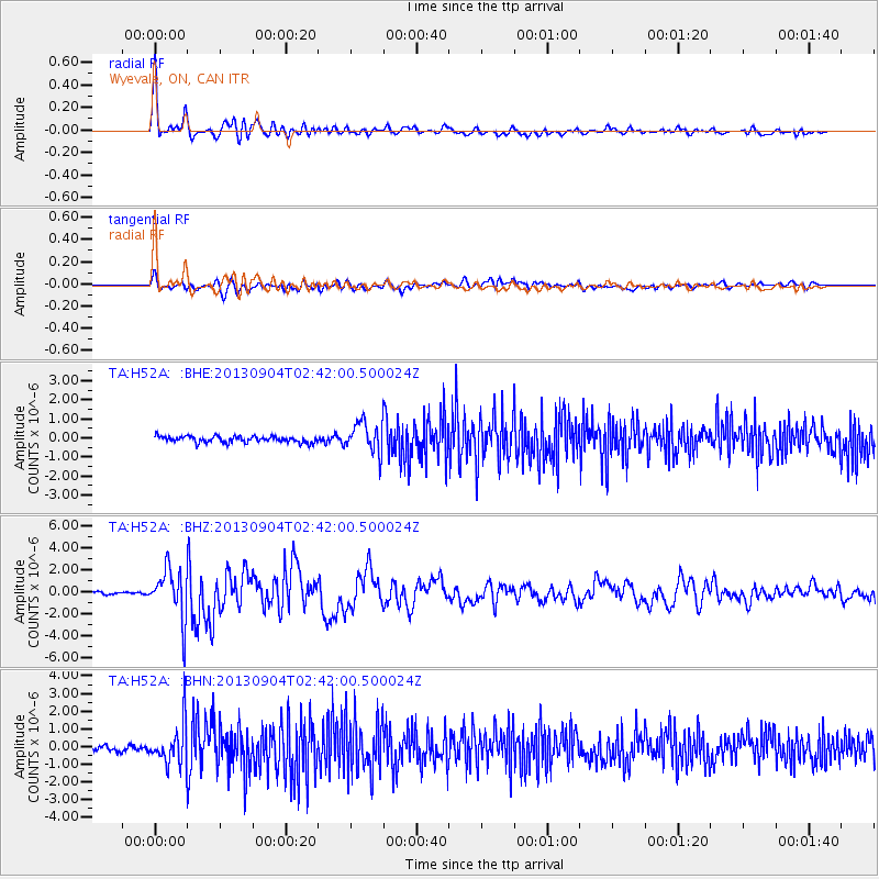
Earthquake location: Andreanof Islands, Aleutian Is.
Earthquake latitude/longitude: 51.6/-174.8
Earthquake time(UTC): 2013/09/04 (247) 02:32:30 GMT
Earthquake Depth: 20 km
Earthquake Magnitude: 6.5 MWW, 5.9 ML, 6.3 MWB, 6.5 MI, 6.5 MWC, 6.5 MWW
Earthquake Catalog/Contributor: NEIC PDE/NEIC COMCAT
Network: TA USArray Transportable Network (new EarthScope stations)
Station: H52A Wyevale, ON, CAN
Lat/Lon: 44.64 N/79.89 W
Elevation: 209 m
Distance: 59.4 deg
Az: 55.733 deg
Baz: 313.72 deg
Ray Param: 0.06219553
Estimated Moho Depth: 39.5 km
Estimated Crust Vp/Vs: 1.75
Assumed Crust Vp: 6.577 km/s
Estimated Crust Vs: 3.764 km/s
Estimated Crust Poisson's Ratio: 0.26
Radial Match: 92.29676 %
Radial Bump: 400
Transverse Match: 77.210304 %
Transverse Bump: 400
SOD ConfigId: 626651
Insert Time: 2014-04-18 10:13:36.197 +0000
GWidth: 2.5
Max Bumps: 400
Tol: 0.001

Signal To Noise

ChannelStoNSTALTA
TA:H52A: :BHZ:20130904T02:42:00.500024Z12.0227472.2692782E-61.8874873E-7
TA:H52A: :BHN:20130904T02:42:00.500024Z8.5209191.1454495E-61.3442792E-7
TA:H52A: :BHE:20130904T02:42:00.500024Z4.8371897.966319E-71.6468901E-7
Arrivals
Ps4.7 SECOND
PpPs16 SECOND
PsPs/PpSs20 SECOND