I46A Reed City, MI, USA - Earthquake Result Viewer
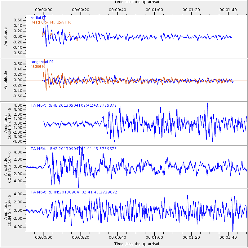
Earthquake location: Andreanof Islands, Aleutian Is.
Earthquake latitude/longitude: 51.6/-174.8
Earthquake time(UTC): 2013/09/04 (247) 02:32:30 GMT
Earthquake Depth: 20 km
Earthquake Magnitude: 6.5 MWW, 5.9 ML, 6.3 MWB, 6.5 MI, 6.5 MWC, 6.5 MWW
Earthquake Catalog/Contributor: NEIC PDE/NEIC COMCAT
Network: TA USArray Transportable Network (new EarthScope stations)
Station: I46A Reed City, MI, USA
Lat/Lon: 43.94 N/85.45 W
Elevation: 359 m
Distance: 56.9 deg
Az: 59.529 deg
Baz: 311.853 deg
Ray Param: 0.063790426
Estimated Moho Depth: 48.0 km
Estimated Crust Vp/Vs: 2.01
Assumed Crust Vp: 6.483 km/s
Estimated Crust Vs: 3.229 km/s
Estimated Crust Poisson's Ratio: 0.33
Radial Match: 88.886925 %
Radial Bump: 400
Transverse Match: 77.49873 %
Transverse Bump: 400
SOD ConfigId: 626651
Insert Time: 2014-04-18 10:14:05.387 +0000
GWidth: 2.5
Max Bumps: 400
Tol: 0.001

Signal To Noise

ChannelStoNSTALTA
TA:I46A: :BHZ:20130904T02:41:43.373987Z7.85296961.8555463E-62.3628594E-7
TA:I46A: :BHN:20130904T02:41:43.373987Z2.95843829.002155E-73.0428743E-7
TA:I46A: :BHE:20130904T02:41:43.373987Z2.96973139.075596E-73.0560327E-7
Arrivals
Ps7.8 SECOND
PpPs21 SECOND
PsPs/PpSs29 SECOND