
I58A Old Forge, NY, USA - Earthquake Result Viewer
| ||||||||||||||||||
| ||||||||||||||||||
| ||||||||||||||||||
|
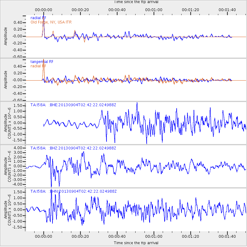
Signal To Noise
| Channel | StoN | STA | LTA |
| TA:I58A: :BHZ:20130904T02:42:22.024988Z | 9.84236 | 1.6374312E-6 | 1.6636571E-7 |
| TA:I58A: :BHN:20130904T02:42:22.024988Z | 3.5025506 | 6.4429537E-7 | 1.8395035E-7 |
| TA:I58A: :BHE:20130904T02:42:22.024988Z | 3.736008 | 6.24851E-7 | 1.6725099E-7 |
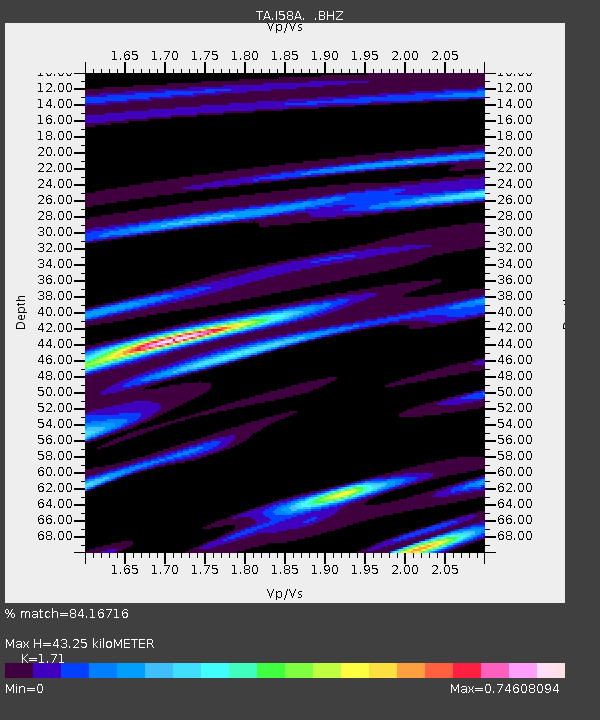
| Arrivals | |
| Ps | 5.0 SECOND |
| PpPs | 17 SECOND |
| PsPs/PpSs | 22 SECOND |

