
J05D Fort Rock, OR, USA - Earthquake Result Viewer
| ||||||||||||||||||
| ||||||||||||||||||
| ||||||||||||||||||
|
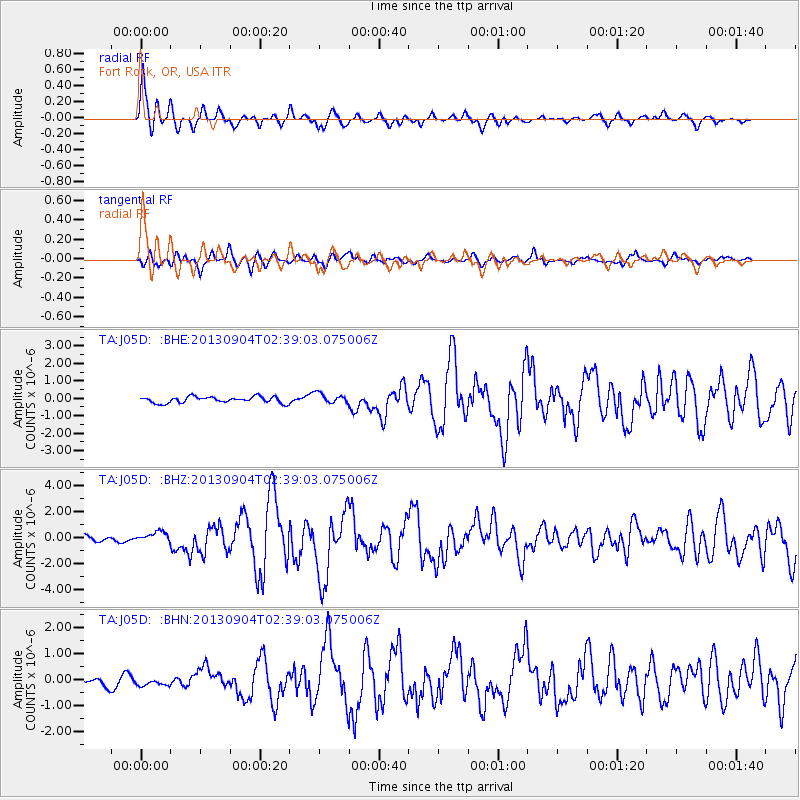
Signal To Noise
| Channel | StoN | STA | LTA |
| TA:J05D: :BHZ:20130904T02:39:03.075006Z | 1.8652079 | 4.2632914E-7 | 2.2856922E-7 |
| TA:J05D: :BHN:20130904T02:39:03.075006Z | 0.727944 | 1.756271E-7 | 2.4126456E-7 |
| TA:J05D: :BHE:20130904T02:39:03.075006Z | 1.6420248 | 2.910033E-7 | 1.7722223E-7 |
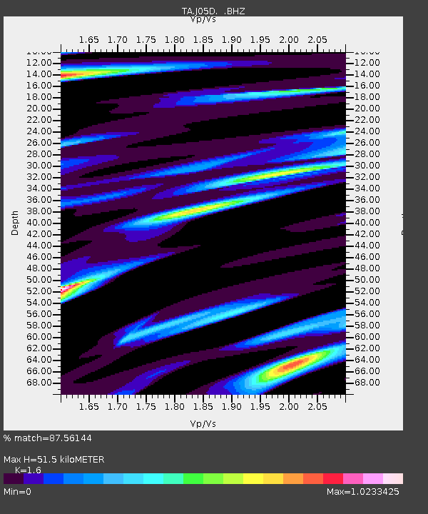
| Arrivals | |
| Ps | 5.1 SECOND |
| PpPs | 19 SECOND |
| PsPs/PpSs | 24 SECOND |

