J49A Marlette, MI, USA - Earthquake Result Viewer
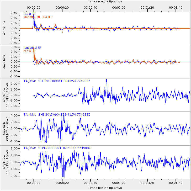
Earthquake location: Andreanof Islands, Aleutian Is.
Earthquake latitude/longitude: 51.6/-174.8
Earthquake time(UTC): 2013/09/04 (247) 02:32:30 GMT
Earthquake Depth: 20 km
Earthquake Magnitude: 6.5 MWW, 5.9 ML, 6.3 MWB, 6.5 MI, 6.5 MWC, 6.5 MWW
Earthquake Catalog/Contributor: NEIC PDE/NEIC COMCAT
Network: TA USArray Transportable Network (new EarthScope stations)
Station: J49A Marlette, MI, USA
Lat/Lon: 43.36 N/83.14 W
Elevation: 253 m
Distance: 58.6 deg
Az: 58.699 deg
Baz: 312.999 deg
Ray Param: 0.062737525
Estimated Moho Depth: 14.75 km
Estimated Crust Vp/Vs: 1.70
Assumed Crust Vp: 6.483 km/s
Estimated Crust Vs: 3.819 km/s
Estimated Crust Poisson's Ratio: 0.23
Radial Match: 89.09608 %
Radial Bump: 400
Transverse Match: 68.59235 %
Transverse Bump: 400
SOD ConfigId: 626651
Insert Time: 2014-04-18 10:14:42.270 +0000
GWidth: 2.5
Max Bumps: 400
Tol: 0.001

Signal To Noise

ChannelStoNSTALTA
TA:J49A: :BHZ:20130904T02:41:54.774988Z6.44526961.4906482E-62.3127787E-7
TA:J49A: :BHN:20130904T02:41:54.774988Z2.535865.7864935E-72.2818662E-7
TA:J49A: :BHE:20130904T02:41:54.774988Z3.62560496.5457976E-71.8054361E-7
Arrivals
Ps1.7 SECOND
PpPs5.8 SECOND
PsPs/PpSs7.5 SECOND