J54A Appleton, NY, USA - Earthquake Result Viewer
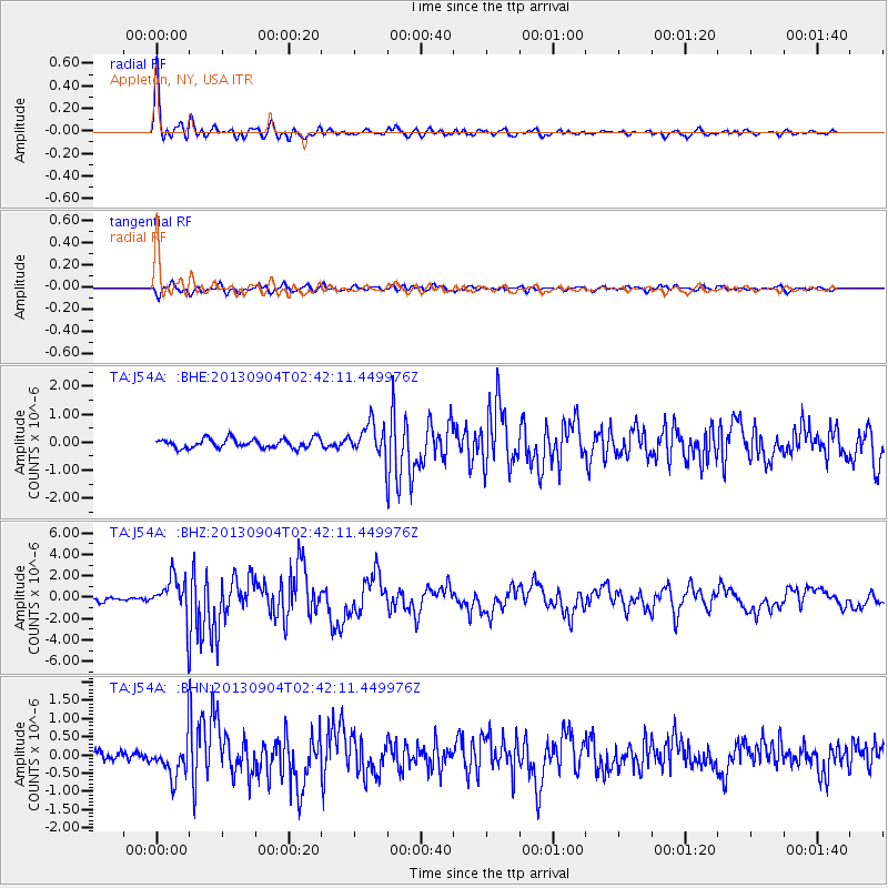
Earthquake location: Andreanof Islands, Aleutian Is.
Earthquake latitude/longitude: 51.6/-174.8
Earthquake time(UTC): 2013/09/04 (247) 02:32:30 GMT
Earthquake Depth: 20 km
Earthquake Magnitude: 6.5 MWW, 5.9 ML, 6.3 MWB, 6.5 MI, 6.5 MWC, 6.5 MWW
Earthquake Catalog/Contributor: NEIC PDE/NEIC COMCAT
Network: TA USArray Transportable Network (new EarthScope stations)
Station: J54A Appleton, NY, USA
Lat/Lon: 43.27 N/78.64 W
Elevation: 112 m
Distance: 61.0 deg
Az: 56.137 deg
Baz: 314.785 deg
Ray Param: 0.061142135
Estimated Moho Depth: 42.25 km
Estimated Crust Vp/Vs: 1.76
Assumed Crust Vp: 6.419 km/s
Estimated Crust Vs: 3.642 km/s
Estimated Crust Poisson's Ratio: 0.26
Radial Match: 95.13878 %
Radial Bump: 400
Transverse Match: 75.83927 %
Transverse Bump: 400
SOD ConfigId: 626651
Insert Time: 2014-04-18 10:14:46.757 +0000
GWidth: 2.5
Max Bumps: 400
Tol: 0.001

Signal To Noise

ChannelStoNSTALTA
TA:J54A: :BHZ:20130904T02:42:11.449976Z8.6360331.951876E-62.2601532E-7
TA:J54A: :BHN:20130904T02:42:11.449976Z3.34247615.043677E-71.5089641E-7
TA:J54A: :BHE:20130904T02:42:11.449976Z3.36776045.6389024E-71.6743776E-7
Arrivals
Ps5.3 SECOND
PpPs17 SECOND
PsPs/PpSs23 SECOND