K43A Burlington, WI, USA - Earthquake Result Viewer
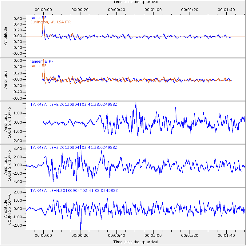
Earthquake location: Andreanof Islands, Aleutian Is.
Earthquake latitude/longitude: 51.6/-174.8
Earthquake time(UTC): 2013/09/04 (247) 02:32:30 GMT
Earthquake Depth: 20 km
Earthquake Magnitude: 6.5 MWW, 5.9 ML, 6.3 MWB, 6.5 MI, 6.5 MWC, 6.5 MWW
Earthquake Catalog/Contributor: NEIC PDE/NEIC COMCAT
Network: TA USArray Transportable Network (new EarthScope stations)
Station: K43A Burlington, WI, USA
Lat/Lon: 42.70 N/88.33 W
Elevation: 264 m
Distance: 56.2 deg
Az: 62.312 deg
Baz: 311.415 deg
Ray Param: 0.06428277
Estimated Moho Depth: 42.75 km
Estimated Crust Vp/Vs: 1.61
Assumed Crust Vp: 6.571 km/s
Estimated Crust Vs: 4.094 km/s
Estimated Crust Poisson's Ratio: 0.18
Radial Match: 87.40154 %
Radial Bump: 400
Transverse Match: 70.79248 %
Transverse Bump: 400
SOD ConfigId: 626651
Insert Time: 2014-04-18 10:15:07.469 +0000
GWidth: 2.5
Max Bumps: 400
Tol: 0.001

Signal To Noise

ChannelStoNSTALTA
TA:K43A: :BHZ:20130904T02:41:38.024988Z8.3213211.3777747E-61.6557163E-7
TA:K43A: :BHN:20130904T02:41:38.024988Z2.1787023.6884788E-71.6929705E-7
TA:K43A: :BHE:20130904T02:41:38.024988Z3.989015.770129E-71.4465066E-7
Arrivals
Ps4.2 SECOND
PpPs16 SECOND
PsPs/PpSs20 SECOND