K46A Dorr, MI, USA - Earthquake Result Viewer
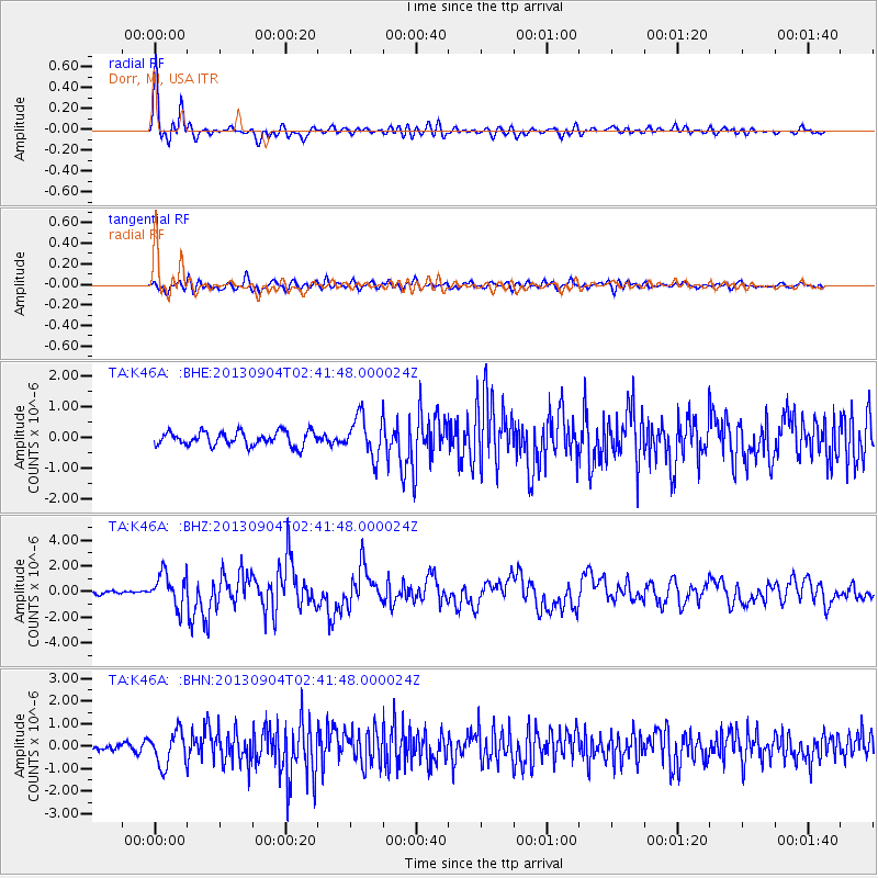
Earthquake location: Andreanof Islands, Aleutian Is.
Earthquake latitude/longitude: 51.6/-174.8
Earthquake time(UTC): 2013/09/04 (247) 02:32:30 GMT
Earthquake Depth: 20 km
Earthquake Magnitude: 6.5 MWW, 5.9 ML, 6.3 MWB, 6.5 MI, 6.5 MWC, 6.5 MWW
Earthquake Catalog/Contributor: NEIC PDE/NEIC COMCAT
Network: TA USArray Transportable Network (new EarthScope stations)
Station: K46A Dorr, MI, USA
Lat/Lon: 42.69 N/85.78 W
Elevation: 213 m
Distance: 57.6 deg
Az: 60.83 deg
Baz: 312.328 deg
Ray Param: 0.06336689
Estimated Moho Depth: 27.0 km
Estimated Crust Vp/Vs: 1.96
Assumed Crust Vp: 6.483 km/s
Estimated Crust Vs: 3.312 km/s
Estimated Crust Poisson's Ratio: 0.32
Radial Match: 84.921585 %
Radial Bump: 400
Transverse Match: 71.28671 %
Transverse Bump: 400
SOD ConfigId: 626651
Insert Time: 2014-04-18 10:15:08.490 +0000
GWidth: 2.5
Max Bumps: 400
Tol: 0.001

Signal To Noise

ChannelStoNSTALTA
TA:K46A: :BHZ:20130904T02:41:48.000024Z7.04378131.2948001E-61.8382174E-7
TA:K46A: :BHN:20130904T02:41:48.000024Z3.51024487.4484814E-72.1219263E-7
TA:K46A: :BHE:20130904T02:41:48.000024Z2.80158356.4931874E-72.3176847E-7
Arrivals
Ps4.2 SECOND
PpPs12 SECOND
PsPs/PpSs16 SECOND