K48A Perry, MI, USA - Earthquake Result Viewer
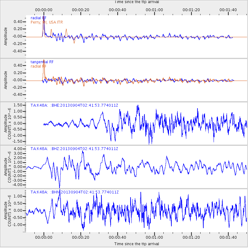
Earthquake location: Andreanof Islands, Aleutian Is.
Earthquake latitude/longitude: 51.6/-174.8
Earthquake time(UTC): 2013/09/04 (247) 02:32:30 GMT
Earthquake Depth: 20 km
Earthquake Magnitude: 6.5 MWW, 5.9 ML, 6.3 MWB, 6.5 MI, 6.5 MWC, 6.5 MWW
Earthquake Catalog/Contributor: NEIC PDE/NEIC COMCAT
Network: TA USArray Transportable Network (new EarthScope stations)
Station: K48A Perry, MI, USA
Lat/Lon: 42.80 N/84.12 W
Elevation: 273 m
Distance: 58.4 deg
Az: 59.751 deg
Baz: 312.881 deg
Ray Param: 0.06283329
Estimated Moho Depth: 67.5 km
Estimated Crust Vp/Vs: 1.88
Assumed Crust Vp: 6.483 km/s
Estimated Crust Vs: 3.448 km/s
Estimated Crust Poisson's Ratio: 0.30
Radial Match: 88.75101 %
Radial Bump: 400
Transverse Match: 59.936436 %
Transverse Bump: 400
SOD ConfigId: 626651
Insert Time: 2014-04-18 10:15:13.380 +0000
GWidth: 2.5
Max Bumps: 400
Tol: 0.001

Signal To Noise

ChannelStoNSTALTA
TA:K48A: :BHZ:20130904T02:41:53.774011Z7.05120231.1662675E-61.653998E-7
TA:K48A: :BHN:20130904T02:41:53.774011Z3.41972164.5315292E-71.3251164E-7
TA:K48A: :BHE:20130904T02:41:53.774011Z3.58281475.1884876E-71.4481596E-7
Arrivals
Ps9.6 SECOND
PpPs29 SECOND
PsPs/PpSs38 SECOND