KMSC Kings Mountain, Blacksburg, SC, USA - Earthquake Result Viewer
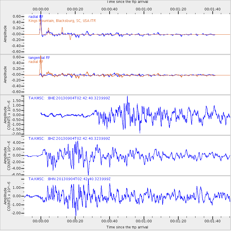
Earthquake location: Andreanof Islands, Aleutian Is.
Earthquake latitude/longitude: 51.6/-174.8
Earthquake time(UTC): 2013/09/04 (247) 02:32:30 GMT
Earthquake Depth: 20 km
Earthquake Magnitude: 6.5 MWW, 5.9 ML, 6.3 MWB, 6.5 MI, 6.5 MWC, 6.5 MWW
Earthquake Catalog/Contributor: NEIC PDE/NEIC COMCAT
Network: TA USArray Transportable Network (new EarthScope stations)
Station: KMSC Kings Mountain, Blacksburg, SC, USA
Lat/Lon: 35.14 N/81.33 W
Elevation: 240 m
Distance: 65.4 deg
Az: 64.166 deg
Baz: 316.715 deg
Ray Param: 0.05830499
Estimated Moho Depth: 45.25 km
Estimated Crust Vp/Vs: 1.62
Assumed Crust Vp: 6.419 km/s
Estimated Crust Vs: 3.956 km/s
Estimated Crust Poisson's Ratio: 0.19
Radial Match: 96.01631 %
Radial Bump: 327
Transverse Match: 88.3192 %
Transverse Bump: 400
SOD ConfigId: 626651
Insert Time: 2014-04-18 10:15:36.536 +0000
GWidth: 2.5
Max Bumps: 400
Tol: 0.001

Signal To Noise

ChannelStoNSTALTA
TA:KMSC: :BHZ:20130904T02:42:40.323999Z12.4765931.2959581E-61.0387116E-7
TA:KMSC: :BHN:20130904T02:42:40.323999Z5.23203954.3092243E-78.236223E-8
TA:KMSC: :BHE:20130904T02:42:40.323999Z4.03583.4130233E-78.456869E-8
Arrivals
Ps4.6 SECOND
PpPs18 SECOND
PsPs/PpSs22 SECOND